" P Yates"
Unframed
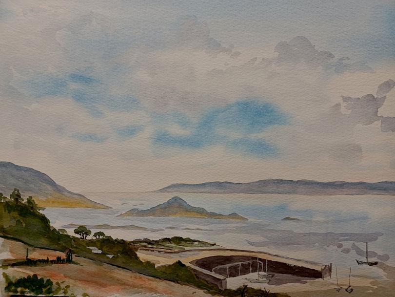
Herm is one of the Channel Islands and part of the Parish of St Peter Port in the Bailiwick of Guernsey. It is located in the English Channel, north-west of France and south of England. It is 2.183 km (1.356 mi) long and under 873 metres (2,864 ft) wide; oriented north–south, with several stretches of sand along its northern coast. The much larger island of Guernsey lies to the west, Jersey lies to the south-east, and the smaller island of Jethou is just off the south-west coast.
Herm was first discovered in the Mesolithic period, and the first settlers arrived in the Neolithic and Bronze Ages. Many tombs from that period remain today, the majority in the north of the island. The island was annexed to the Duchy of Normandy in 933, but returned to the English Crown with the division of Normandy in 1204. It was occupied by Germany in the Second World War and the scene of Operation Huckaback, but was largely bypassed. Herm is currently managed by Herm Island Ltd, formed by Starboard Settlement, who acquired Herm in 2008, following fears during the sale of the island that the 'identity' of the island was at threat.
Herm's harbour is on its west coast. There are several buildings of note in the vicinity including the White House, St Tugual's Chapel, Fisherman's Cottage, "The Mermaid" pub and restaurant, and a small primary school with about eight children. During a busy summer season up to 100,000 tourists visit the island, arriving by one of the catamaran ferries operated by the Trident Charter Company. Cars are banned from the island, as are bicycles; quad bikes and tractors used for staff and luggage transport respectively are allowed.
Herm was first found in the Mesolithic period (between 10,000 and 8,000 BC), when hunters were in search of food. In the Neolithic and Bronze Ages, settlers arrived; the remains of chamber tombs have been found on the island, and may be seen today; specifically on the Common, and the Petit and Grand Monceau; it has been suggested that the northern end of the island, i.e. the Common, was set apart for burials. After a three-year project by the University of Durham, supported by specialists from the University of Cambridge, the University of Oxford, and the Guernsey museum, they stated that the "density of tombs suggests that the northern end of Herm may have been a place set apart for funerary activity".
The first records of Herm's inhabitants in historic times are from the 6th century, when the island became a centre of monastic activity; the followers of Saint Tugual (also called Tudwal) arrived, establishing Saint Tugual's Chapel. In 709, a storm washed away the strip of land which connected the island with Jethou.
An important moment in Herm's political history was in 933, when the Channel Islands were annexed to the Duchy of Normandy, they remained so until the division of Normandy in 1204, when they became a Crown Dependency. In 1111 Brother Claude Panton was a hermit in "Erm": 126 and in 1117 the then hermit, Brother Francis Franche Montague is recorded as living on "Erm": 131 After the annexation, Herm gradually lost its monastic inhabitants, and between 1570 and 1737 the governors of Guernsey used it as a hunting ground; visiting to shoot, hunt, and fish.
In 1810, an inn was founded; and during the Industrial Revolution, roads, paths, a harbour, accommodation, a forge, blacksmiths, a brewery, a bakery and a prison were built to cater for the largest number of inhabitants since prehistoric times. Most were quarrymen working in new granite quarries. Several quarries can still be seen at present, such as on the Common.[4] When the Prince[4] and Princess Blücher[10] leased the island from the British government in 1889, he introduced a colony of red-necked wallabies to the island, which lasted until 1910. Offspring were "said to have been eaten as food by English soldiers occupying the island during World War 2".
Compton Mackenzie, an English-born Scottish novelist, acquired the tenancy in 1920. He recalled that his three years there had numerous logistical problems. It has been suggested that Mackenzie was the basis for the character Mr Cathcart in D.H. Lawrence's The Man who Loved Islands, about a man who moved to ever smaller islands much as Mackenzie moved from Herm to the smaller Jethou, but Lawrence himself denied it.
The German occupation of the Channel Islands during the Second World War essentially by-passed Herm. The island was claimed on 20 July 1940 by Nazi Germany, a few weeks after the arrival of German troops in Guernsey and Jersey; German soldiers landed on the island to shoot a propaganda film, The Invasion of the Isle of Wight. Herm's sandy beaches were soon used for practising landings from barges, in preparation for the invasion of England, but otherwise the island saw little of the Germans beyond officers making trips to shoot rabbits.Herm had only a little German construction during the war; a flak battery was placed on the island for a few weeks, and mines were placed in an area. Occasionally German soldiers would travel to Herm to cut wood for fuel.
Operation Huckaback was a British Second World War military operation that was originally designed to be a raid on Herm, Jethou and Brecqhou, but instead became only a raid on Herm undertaken on the night of 27 February 1943, following an earlier attempt that had been aborted.[16] Ten men of the Small Scale Raiding Force and No. 4 Commando under Captain Patrick Anthony Porteous VC landed 200 yards to the north-west of Selle Rocque on a shingle beach and made several unsuccessful attempts to climb the cliff in front of them. Porteous finally managed to climb up the bed of a stream and pulled the others up with a rope. They later reported that they had found no sign of any Islanders or Germans (who were supposed to be billeted near the harbour). They had failed to make contact with the few civilians on the island whose duties included looking after the sheep.
In 1949, the States of Guernsey bought Herm from the Crown because of the "unspoilt island idyll that could be enjoyed by locals and tourists alike". One of the island's most influential tenants was Major Peter Wood, who looked after the island from 1949 to 1980 with his wife. The island was run down when he arrived, with the manor hidden in undergrowth, the windows and roofs of the houses having been blown off by a sea mine drifting into the harbour shortly after their arrival, but they created a school, and restored St Tugual's Chapel. Major Wood's daughter Pennie Wood Heyworth and her husband Adrian succeeded them; Major Wood died in 1998. Their early efforts are recorded in Herm, Our Island Home, written by Major Wood's wife Jenny Wood.
On 17 May 2008, the BBC reported that the tenants had put the remaining 40 years of their lease up for sale, with an asking price of £15,000,000. Within four days, there were over 50 potential buyers. In September 2008 it was announced that Starboard Settlement, a trust, had acquired the remainder of the lease for considerably less than the asking price. The trust formed a company based in Guernsey, Herm Island Ltd, to manage the island for the trustees.
In 2013, negotiations for a 21-year extension to the lease broke down, with the tenant offering £440,000 and the owner requesting £6,000,000 plus improvements to infrastructure.
Herm is only 1+1⁄2 miles long (north-south) and less than half a mile wide (east-west). In the northern part of the island are two hills, Le Petit Monceau and Le Grand Monceau. To the north of these is a common, leading to Mouisonniere Beach on the northern coast, with Oyster Point in the northwestern corner and La Pointe du Gentilhomme or Alderney Point at the northeastern corner. To the east of the common is Shell Beach and to the west is The Bear's Beach, leading down to the harbour. Half of the coastline of the northern part of the island is surrounded by sandy beaches; the southern half is rocky. Much of Herm's bedrock is granite. In 2008, Adrian Heyworth, who was at the time the island's tenant, said that two or three metres of sand were being lost annually at Alderney Point. Interestingly, the northernmost point of the island, Alderney Point, sits directly south of the Isle of Portland.
Off the northwestern coast of Herm is the islet of Le Plat Houmet, and beyond that Fondu, which like Herm belongs to Guernsey. In Belvoir Bay on the eastern side of the island are the islets of Mouliere, situated off Frenchman's Point which is to the northeast of the manor village, and Caquorobert., the latter of which can be accessed at low tide via a vaguely marked path. To the south of this off the southeastern coast is Puffin Bay, which contains the islet of Putrainez near the coast and the islet of Selle Rocque further out to the south. The far southwestern point of the island is Point Sauzebourge, and Bishop's Cove is just to the north of this.] North of the cove and south along the beach from the harbour and White House are the Rosiere Steps, with a quarry and cottage of the same name in the vicinity. The Mouette and Percee reefs are offshore here. Hermetier, also known as Rat's Island, lies about 250 m (820 ft) off the western coast between Fisherman's Beach and The Bear's Beach, to the north of the harbour, linked by a low causeway from the beach. The islet can be accessed at low tide from the beach around Fisherman's Cottage.
The isle of Jethou is around three-quarters of a mile to the southwest beyond Point Sauzebourge. It is possible that in AD 709 a storm washed away the strip of land that connected Jethou to Herm. About 215 m (705 ft) off the northern coast of Jethou is the islet of Crevichon, which measures about 212 by 168 m (696 by 551 ft), with an area of less than three hectares. To the west, between Herm and Guernsey, lies the channel Little Roussel (Petit Ruau); between Herm and Sark, to the east, lies the Big Roussel (Grand Ruau). Bréhon Tower, a Victorian-era fortification, is in the Little Roussel between Herm and Saint Peter Port.The tower was created between 1854 and 1856 by Thomas Charles de Putron (1806–1869) using granite from Herm