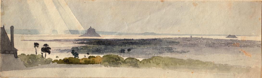
fro sketch book
Le Mont-Saint-Michel English: Saint Michael's Mount) is an island commune in Normandy, France. It is located about one kilometre (0.6 miles) off the country's northwestern coast, at the mouth of the Couesnon River near Avranches. 100 hectares (247 acres) in size, the island has a population of 44 (2009).
The island has held strategic fortifications since ancient times and since the 8th century AD has been the seat of the monastery from which it draws its name. The structural composition of the town exemplifies the feudal society that constructed it: on top, God, the abbey and monastery; below, the great halls; then stores and housing; and at the bottom, outside the walls, houses for fishermen and farmers.
Its unique position — on an island just 600 metres from land — made it accessible at low tide to the many pilgrims to its abbey, but defensible as an incoming tide stranded, drove off, or drowned, would-be assailants. The Mont remained unconquered during the Hundred Years' War; a small garrison fended off a full attack by the English in 1433. The reverse benefits of its natural defence were not lost on Louis XI, who turned the Mont into a prison. Thereafter the abbey began to be used more regularly as a jail during the Ancien Régime. One of France's most recognizable landmarks, Mont Saint-Michel and its bay are part of the UNESCO list of World Heritage Sites and more than 3 million people visit it each year.Now a rocky tidal island, the Mont occupied dry land in prehistoric times. As sea levels rose, erosion reshaped the coastal landscape, and several outcrops of granite emerged in the bay, having resisted the wear and tear of the ocean better than the surrounding rocks. These included Lillemer, the Mont-Dol, Tombelaine (the island just to the north), and Mont Tombe, later called Mont Saint-Michel.
Mont Saint-Michel is made of leucogranite, which solidified from an underground intrusion of molten magma about 525 million years ago, during the Cambrian period, as one of the younger parts of the Mancellian granitic batholith.[5] (Early studies of Mont Saint-Michel by French geologists sometimes describe the leucogranite of the Mont as "granulite", but this granitic meaning of granulite is now obsolete). The Mont has a circumference of about 960 metres (3,150 ft), and is 92 metres (302 ft) above sea level at its highest point.
The tides can vary greatly, at roughly 14 metres (46 ft) between high and low water marks. Popularly nicknamed "St. Michael in peril of the sea" by medieval pilgrims making their way across the flats, the mount can still pose dangers for visitors who avoid the causeway and attempt the hazardous walk across the sands from the neighbouring coast. Polderisation and occasional flooding have created salt marsh meadows that were found to be ideally suited to grazing sheep. The well-flavoured meat that results from the diet of the sheep in the pré salé (salt meadow) makes agneau de pré-salé (salt meadow lamb) a local specialty that may be found on the menus of restaurants that depend on income from the many visitors to the mount. The connection between Mont Saint-Michel and the mainland has changed over the centuries. Previously connected by a tidal causeway (a path uncovered only at low tide), this was converted into a raised (permanently dry) causeway in 1879, preventing the tide from scouring the silt around the mount. The coastal flats have also been polderised to create pastureland, decreasing the distance between the shore and the island, and the Couesnon River has been canalised, reducing the dispersion of the flow of water. These factors all encouraged silting-up of the bay. On 16 June 2006, the French prime minister and regional authorities announced a €164 million project (Projet Mont-Saint-Michel)[8] to build a hydraulic dam using the waters of the river Couesnon and the tides to help remove the accumulated silt, and to make Mont Saint-Michel an island again. The project's completion is scheduled for 2015.
The construction of the dam began in 2009. The project also includes the removal of the causeway and its visitor car park. Since 28 April 2012 the new car park on the mainland has been located 2.5 kilometres (1.6 miles) from the island. Visitors can walk or use shuttles to cross the causeway. On 22 July 2014 the new bridge by architect Dietmar Feichtinger was opened to the public. The light bridge allows the waters to flow freely around the island and improves the efficiency of the now operational dam. The project which cost €209m was officially opened by President Francois Hollande. On rare occasions tidal circumstances produce an extremely high 'supertide'. The new bridge was completely submerged on 21 March 2015, by the highest sea level for at least 18 years, as crowds gathered to snap photos.Mont Saint-Michel was used in the sixth and seventh centuries as an Armorican stronghold of Gallo-Roman culture and power until it was ransacked by the Franks, thus ending the trans-channel culture that had stood since the departure of the Romans in AD 460. From roughly the fifth to the eighth century, Mont Saint-Michel belonged to the territory of Neustria, and in the early ninth century was an important place in the marches of Neustria.
Before the construction of the first monastic establishment in the 8th century, the island was called Mont Tombe (Latin: tumba). According to legend, the Archangel Michael appeared in 708 to St. Aubert, the bishop of Avranches, and instructed him to build a church on the rocky islet. Aubert repeatedly ignored the angel's instruction until Michael burned a hole in the bishop's skull with his finger. Unable to defend his kingdom against the assaults of the Vikings, the king of the Franks agreed to grant the Cotentin peninsula and the Avranchin, including Mont-Saint-Michel, to the Bretons in the 867 Treaty of Compiègne. This marked the beginning of the brief period of Breton possession of the Mont. In fact, these lands and Mont Saint-Michel were never really included in the duchy of Brittany and remained independent bishoprics from the newly created Breton archbishopric of Dol. When Rollo confirmed Franco as archbishop of Rouen, these traditional dependences of the Rouen archbishopric were retained in it. The mount gained strategic significance again in 933 when William "Long Sword" annexed the Cotentin Peninsula from the weakened Dukes of Brittany. This made the mount definitively part of Normandy, and is depicted in the Bayeux Tapestry, which commemorates the 1066 Norman conquest of England. Harold, Earl of Wessex is pictured on the tapestry rescuing two Norman knights from the quicksand in the tidal flats during a battle with Conan II, Duke of Brittany. Norman ducal patronage financed the spectacular Norman architecture of the abbey in subsequent centuries.
Bayeux Tapestry scenes 16 and 17: William and Harold at Mont Saint-Michel (at top center); Harold rescuing knights from quicksand
In 1067, the monastery of Mont Saint-Michel gave its support to Duke William of Normandy in his claim to the throne of England. This he rewarded with properties and grounds on the English side of the Channel, including a small island off the south-western coast of Cornwall which was modelled after the Mount and became a Norman priory named St Michael's Mount of Penzance. Cannons abandoned by Thomas de Scales at Mont Saint-Michel on 17 June 1434. Currently (June 2013), only the second cannon, the one closer to the wall, is on display inside the entrance to the Mont's outer wall. During the Hundred Years' War, the English made repeated assaults on the island, but were unable to seize it due to the abbey's improved fortifications. The English initially besieged the Mont in 1423–24, and then again in 1433–34 with English forces under the command of Thomas Scales. Two wrought-iron bombards that Scales abandoned when he gave up his siege are still on site. They are known as les Michelettes. Mont Saint-Michel's resolute resistance inspired the French, especially Joan of Arc.When Louis XI of France founded the Order of Saint Michael in 1469, he intended that the abbey church of Mont Saint-Michel become the chapel for the Order, but because of its great distance from Paris, his intention could never be realized. The wealth and influence of the abbey extended to many daughter foundations, including St. Michael's Mount in Cornwall. However, its popularity and prestige as a centre of pilgrimage waned with the Reformation, and by the time of the French Revolution there were scarcely any monks in residence. The abbey was closed and converted into a prison, initially to hold clerical opponents of the republican regime. High-profile political prisoners followed, but by 1836, influential figures—including Victor Hugo—had launched a campaign to restore what was seen as a national architectural treasure. The prison was finally closed in 1863, and the mount was declared an historic monument in 1874. Mont Saint-Michel and its bay were added to the UNESCO list of World Heritage Sites in 1979, and it was listed with criteria such as cultural, historical, and architectural significance, as well as human-created and natural beauty.
In the 11th century, William de Volpiano, the Italian architect who had built the Abbey of Fécamp in Normandy, was chosen by Richard II of Normandy to be the building contractor. He designed the Romanesque church of the abbey, daringly placing the transept crossing at the top of the mount. Many underground crypts and chapels had to be built to compensate for this weight; these formed the basis for the supportive upward structure that can be seen today. Today Mont Saint-Michel is seen as a building of Romanesque architecture.
Robert de Thorigny, a great supporter of Henry II of England (who was also Duke of Normandy), reinforced the structure of the buildings and built the main façade of the church in the 12th century. In 1204, Guy de Thouars, regent for the Duchess of Brittany, as vassal of the King of France, undertook a siege of the Mount. After having set fire to the village and having massacred the population, he was obliged to beat a retreat under the powerful walls of the abbey. Unfortunately, the fire which he himself lit extended to the buildings, and the roofs fell prey to the flames. Horrified by the cruelty and the exactions of his Breton ally, Philip Augustus offered Abbot Jordan a grant for the construction of a new Gothic architectural set which included the addition of the refectory and cloister.Charles VI is credited with adding major fortifications to the abbey-mount, building towers, successive courtyards, and strengthening the ramparts.