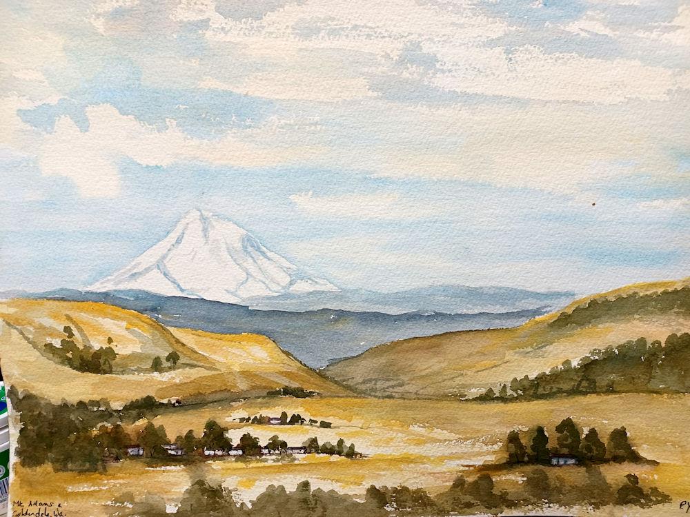
" P Yates" inscribed on the reverse
unframed
Mount Adams, known by some Native American tribes as Pahto or Klickitat, is a potentially active stratovolcano in the Cascade Range. Although Adams has not erupted in more than 1,000 years, it is not considered extinct. It is the second-highest mountain in Washington, after Mount Rainier. Adams, named for President John Adams, is a member of the Cascade Volcanic Arc, and is one of the arc's largest volcanoes, located in a remote wilderness approximately 34 miles (55 km) east of Mount St. Helens. The Mount Adams Wilderness consists of the upper and western part of the volcano's cone. The eastern side of the mountain is designated as part of the territory of the Yakama Nation.
Adams' asymmetrical and broad body rises 1.5 miles (2.4 km) above the Cascade crest. Its nearly flat summit was formed as a result of cone-building eruptions from separated vents. The Pacific Crest Trail traverses the western flank of the mountain.Mount Adams stands 37 miles (60 km) east of Mount St. Helens and about 50 miles (80 km) south of Mount Rainier. It is 30 miles (48 km) north of the Columbia River and 55 miles (89 km) north of Mount Hood in Oregon. The nearest major cities are Yakima, 50 miles (80 km) to the northeast, and the Portland metropolitan area, 60 miles (97 km) to the southwest. Between half and two thirds of Adams is within the Mount Adams Wilderness of the Gifford Pinchot National Forest. The remaining area is within the Mount Adams Recreation Area of the Yakama Indian Reservation. While many of the volcanic peaks in Oregon are located on the Cascade Crest, Adams is the only active volcano in Washington to be so. It is farther east than all the rest of Washington's volcanoes except Glacier Peak.
Adams is one of the long-lived volcanoes in the Cascade Range, with minor activity beginning 900,000 years ago and major cone building activity beginning 520,000 years ago. The whole mountain has been completely eroded by glaciers to an elevation of 8,200 feet (2,500 m) twice during its lifetime. The current cone was built during the most recent major eruptive period 40,000–10,000 years ago.
Standing at 12,281 feet (3,743 m), Adams towers about 9,800 feet (3,000 m) over the surrounding countryside. It is the second-highest mountain in Washington and third-highest in the Cascade Range. Because of the way it developed, it is the largest stratovolcano in Washington and second-largest in the Cascades, behind only Mount Shasta. Its large size is reflected in its 18 miles (29 km)-diameter base, which has a prominent north–south trending axis.
Adams is the source of the headwaters for two major rivers, the Lewis River and White Salmon River. The many streams that emanate from the glaciers and from springs at its base flow into two more major river systems, the Cispus River and the Klickitat River. The streams on the north and west portions of Adams feed the Cispus River, which joins the Cowlitz River near Riffe Lake, and the Lewis River.
To the south, the White Salmon River has its source on the lower flanks of the west side of Adams and gains additional flows from streams along the southwest side of the mountain. Streams on the east side all flow to the Klickitat River. Streams on all sides, at some point in their courses, provide essential irrigation water for farming and ranching. The Klickitat and White Salmon rivers are nearly completely free flowing, with only small barriers to aid irrigation (White Salmon) and erosion control (Klickitat). The Cispus and Lewis rivers have been impounded with dams farther downstream for flood control and power generation purposes.
Mount Adams is the second-most isolated, in terms of access, stratovolcano in Washington; Glacier Peak is the most isolated. Only two major highways pass close to it. Highway 12 passes about 25 miles to the north of Adams through the Cascades. Highway 141 comes within 13 miles of Adams as it follows the White Salmon River valley up from the Columbia River to the small town of Trout Lake. From either highway, travelers have to use Forest Service roads to get closer to the mountain. The main access roads, FR 23, FR 82, FR 80, and FR 21, are paved for part of their length. Most all other roads are gravel or dirt, with varying degrees of maintenance.Access to the Mount Adams Recreation Area is by way of FR 82, which becomes BIA 285 at the Yakama reservation boundary. BIA 285 is known to be extremely rough and often suitable only for trucks or high-clearance vehicles. Two small towns, Glenwood and Trout Lake, are located in valleys less than 15 miles from the summit, Glenwood on the southeast quarter and Trout Lake on the southwest quarter.
Its size and distance from major cities, and the tendency of some people to forget or ignore Mount Adams, has led some people to call this volcano "The Forgotten Giant of Washington."
On a clear day from the summit, other visible volcanoes in the Cascade Range include Mount Rainier, Mount Baker, and Glacier Peak to the north, Mount St. Helens to the west, all in Washington; and Mount Hood, Mount Jefferson, and the Three Sisters, all to the south in Oregon
Native Americans in the area have composed many legends concerning the three "smoking mountains" that guard the Columbia River. According to the Bridge of the Gods tale, Wy'east (Mount Hood) and Pahto (Mount Adams; also called Paddo or Klickitat by native peoples) were the sons of the Great Spirit. The brothers both competed for the love of the beautiful La-wa-la-clough (Mount St. Helens). When La-wa-la-clough chose Pahto, Wy'east struck his brother hard so that Pahto's head was flattened and Wy'east took La-wa-la-clough from him (thus attempting to explain Adams' squat appearance).[13] Other versions of the story state that losing La-wa-la-clough caused Pahto such grief that he dropped his head in shame.[65][66][67]
In a legend from the Klickitats, the chief of the gods, Tyhee Saghalie, came to The Dalles with his two sons. The sons quarreled about who would settle where. To settle the dispute, Saghalie shot an arrow to the west and to the north and told his sons to find them and to settle where the arrows had fallen. So one settled in the Willamette Valley and the other in the area between the Yakima and Columbia Rivers and they became the ancestors of the Multnomah and Klickitat tribes respectively. To separate the tribes, Saghalie raised the Cascade Mountains. He also created the "Bridge of the Gods" as a way for the tribes to meet with one another easily. A "witch-woman," whose name was Loowit, lived on the bridge and had control of the only fire in the world. She wanted to give the tribes fire to improve their condition and Saghalie consented. He was so pleased with Loowit's faithfulness that he offered Loowit whatever she wanted. She asked for youth and beauty and Saghalie granted her wish. Suitors came from near and far until finally she could not decide between Klickitat and Wiyeast. Klickitat and Wiyeast went to war over the matter until finally Sahalie decided to punish them for creating such chaos. He broke the Bridge of the Gods and put the three lovers to death. However, in order to honor their beauty, he raised up three mountains: Wiyeast (Hood), Klickitat (Adams), and Loowit (St. Helens).[26][68][69][70][71]
In a similar legend from the Klickitats, there was a large inland sea between the Cascades and the Rocky Mountains. The Native Americans lived on the sea and each year they would hold two large powwows at Mount Multnomah, one in the spring and one in the fall. The demigod Koyoda Spielei lived among them and settled disputes among the living things of the earth, including the mountains Pa-toe (Adams) and Yi-east (Hood), sons of the Great Spirit Soclai Tyee. For many years, peace prevailed over the land. Then a beautiful squaw mountain moved to the valley between Pa-toe and Yi-east. She fell in love with Yi-east, but liked to flirt with Pa-toe. This caused the two mountains to quarrel with each other and it quickly escalated into an all out brawl. Ignoring Koyoda's calls for peace, they belched forth smoke and ash and threw hot rocks at each other. Some time later, they paused for a rest and discovered the catastrophe they had caused. The forests and meadows had been burnt to the ground and many animals and other living things had been killed. The earth had been shaken so severely that a hole had been created in the mountains and the sea had drained away and the Bridge of the Gods was formed. The squaw mountain had hid herself in a cave during the battle and because they could no longer find her, they were about to resume fighting. However, while they had been fighting, Koyoda went to Soclai and told him what was happening. Soclai arrived in time to stop them from resuming their quarrel. He decreed that the squaw mountain should remain in the cave forever and the Bridge of the Gods was to be a covenant of peace between the mountains that he would cause to fall if they ever resumed their quarrel. He also placed an ugly old woman, known as Loo-wit, as a mountain to guard the bridge and remind the brothers that beauty is never permanent. After many years, the signs of the great battle and the evidence of the inland sea had disappeared and there was happiness and contentment over the earth. The squaw mountain wished to come out of her cave and grew very lonely. In an effort to ease her loneliness, Soclai sent the Bats, a tribe of beautiful birds, to be her companions. Yi-east eventually learned that the Bats were her guardians and carried out secret communication with the squaw mountain through them. He befriended Loo-wit and crossed the bridge at night to meet with the squaw mountain. One night, he stayed too long and had to hurry to get back to his proper place. He caused the ground to shake so much in his haste that a large rock fell and blocked the entrance to the cave. When Soclai found this, he was furious with the Bats and punished them by turning them into bats that are seen today. He allowed the squaw mountain to remain out of the cave on her promise to be good, but would not allow her and Yi-east to be married, fearing the inevitable quarrel that might start again. He did promise to look for a mate for Pa-toe, hoping this would initiate a lasting peace. However, because of his many duties, he forgot this promise and the two mountains were only held in check by his threats. Eventually, when Soclai was in another part of the world, they resumed their quarrel and created chaos again. Their violence broke the Bridge of the Gods and destroyed the landscape again. Loo-wit, in her attempts to stop the two brothers, was badly burned and scarred; and when the bridge collapsed, she fell with it. Finally, Pa-toe won the battle and Yi-east admitted defeat. Soclai returned from where he had been, but he was too late to avert the disaster. He found Loo-wit and because she had been faithful in her guardianship, he rewarded her by giving her her greatest desire, youth and beauty. Having received this gift, she moved to the west side of the Cascades and remains there to this day as Mount St. Helens. Since Pa-toe won the battle, the squaw mountain belonged to him. She was heart broken, but took her place at his side. She soon fell at his feet and into a deep sleep from which she never awoke. She is now known as Sleeping Beauty. Pa-toe became so sad that he caused her deep sleep, he lowered his own head in remorse.
The Yakamas also have a legend attempting to explain Adams' squat appearance. Long ago, the Sun was a man and he had five wives who were mountains: Plash-Plash (the Goat Rocks), Wahkshum (the Simcoe Mountains), Pahto (Adams), Rainier, and St. Helens. Because she was the third wife to be greeted by the Sun in the morning, Pahto became jealous. She broke down both Plash-Plash and Wahkshum, but left Rainier and St. Helens alone. She was happy that she was now the first to be greeted, but wanted more, so she crossed the Columbia and took plants and animals from the mountains there. The other mountains were afraid of her, but Klah Klahnee (the Three Sisters) convinced Wyeast (Hood) to confront Pahto. Wyeast initially tried being nice, but Pahto would have none of it. So Wyeast hit her head and knocked it off, creating Devils Garden. Wyeast then shared what Pahto had taken with the rest of the mountains. After this, Pahto became mean and she would send thunderstorms, heavy rain, and snow to the valleys below. The Great Spirit had been watching all this time and came to Pahto. He gave her a new head in the form of White Eagle and his son Red Eagle and he reminded her that she was his daughter. Pahto repented and promised to stop being mean and greedy.
In many of the legends of the Cascade Mountains, there are thunderbirds that live on them and Adams is no exception. This particular thunderbird was named Enumtla and he terrorized the inhabitants of the land. Speelyi, the Klickitat coyote god, came along one day and they implored him to do something. Speelyi transformed himself into a feather and waited. It did not take long for Enumtla to see the feather and investigate. Being suspicious, he thundered at the feather with no effect. He paused and suddenly the magic feather let loose a terrific volley of thunder and lightning and stunned Enumtla. Speelyi then managed to overpower Enumtla and decreed that the thunderbird could no longer terrify the people, could only thunder on hot days, and could not destroy with lightning.
Several other tribes have legends involving battles and disagreements between the great peaks. The Cowlitz and Chehalis have a legend where Rainier and St. Helens were female mountains and quarreled over Adams, the male mountain. In a different legend from the Cowlitz, St. Helens was the man and Pahto (Adams) and Takhoma (Rainier) were his wives and the two wives quarreled with each other. A thunderbird legend from the Yakamas has a terrific battle between the thunderbird, Enumklah, and his five wives, Tahoma (Rainier), Pahto (Adams), Ah-kee-kun (Hood), Low-we-lat-Klah (St. Helens), and Simcoe. Pahto and Tahoma were badly beaten, Ah-kee-kun and Low-we-lat-Klah escaped without injury, and Simcoe suffered the greatest injury for starting the battle.
Adams was known to the Native Americans as Pahto (with various spellings) and Klickitat. In various tribal languages (Plateau Penutian, Chinookan, Salishan), Pahto means high up, very high, standing up, or high sloping mountain. The Klickitat name is of Klickitat origin and comes from the Chinookan for beyond.
In 1805, on the journey westward down the Columbia, the Lewis and Clark Expedition recorded seeing the mountain; noting that it was "a high mountain of emence hight covered with snow" and thought it "perhaps the highest pinnacle in America." They initially misidentified it as Mount St. Helens, which had been previously discovered and named by George Vancouver. On the return journey in 1806, they recorded seeing both, but did not give Adams a name, only calling it "a very high humped mountain". This is the earliest recorded sighting of the volcano by European explorers.
For several decades after Lewis and Clark sighted the mountain, people continued to get Adams confused with St. Helens, due in part to their somewhat similar appearance and similar latitude. In the 1830s, Hall J. Kelley led a campaign to rename the Cascade Range as the President's Range and rename each major Cascade mountain after a former President of the United States. Mount Adams was not known to Kelley and was thus not in his plan. Mount Hood, in fact, was designated by Kelley to be renamed after President John Adams and St. Helens was to be renamed after George Washington. In a mistake or deliberate change by mapmaker and proponent of the Kelley plan, Thomas J. Farnham, the names for Hood and St. Helens were interchanged. And, likely because of the confusion about which mountain was St. Helens, he placed the Mount Adams name north of Mount Hood and about 40 miles (64 km) east of Mount St. Helens. By what would seem sheer coincidence, there was in fact a large mountain there to receive the name. Since the mountain had no official name at the time, Kelley's name stuck even though the rest of his plan failed. However, it was not official until 1853, when the Pacific Railroad Surveys, under the direction of Washington Territory governor Isaac I. Stevens, determined its location, described the surrounding countryside, and placed the name on the map.
Since its discovery by explorers, the height of Adams has also been subject to revision. The topographer for the Pacific Railroad Surveys, Lt. Johnson K. Duncan, and George Gibbs, ethnologist and naturalist for the expedition, thought it was about the same height as St. Helens. Its large, uneven size apparently contributed to the underestimation. The Northwest Boundary Survey listed Adams as having an elevation of 9,570 feet (2,920 m) while a later US Coast and Geodetic Survey gave it an elevation of 11,906 feet (3,629 m). The height was more closely determined in 1895 by members of the Mazamas mountaineering club, William A. Gilmore, Professor Edgar McClure, and William Gladstone Steel. Using a boiling point thermometer, mercurial barometer, and an aneroid barometer, they determined the elevation to be 12,255, 12,402, and 12,150 feet (3,735, 3,780, and 3,703 m) respectively.[80] None of these numbers were used on any map because that same year, 1895, the US Geological Survey (USGS), using a triangulation method, also measured the height of several mountains in the Cascades and they measured Adams as having an elevation of 12,470 feet (3,800 m). The USGS further refined their measurement sometime in late 1909 or early 1910 to 12,307 feet (3,751 m) and again in 1970 to 12,276 feet (3,742 m) for the release of the Mount Adams East 1:24000 quadrangle. The current elevation, 12,281 feet (3,743 m), is generated by the new method, NAVD88, for calculating altitudes.
Claude Ewing Rusk, a local settler and mountaineer, was one of those most familiar with Adams and he was instrumental in many of the names given to places around the mountain. In 1890, he, his mother Josie, and his sister Leah completed a circuit of the mountain and explored, to some extent, all ten of its principle glaciers. This was the first recorded circuit of Adams by a woman and likely the first recorded circuit by anyone.[56] While they were on the east side, they named Avalanche Valley. Later, in 1897, after they had completed an ascent of Adams, they went to the Ridge of Wonders and his mother, awestruck by the scene, named it as such.
No detailed descriptions of Adams or its glaciers existed until Professor William Denison Lyman and Horace S. Lyman published descriptions of three of its glaciers and various other features of the southern flanks of the mountain in 1886. The White Salmon/Avalanche, Mazama, and Klickitat Glaciers were those described. They also postulated Adams to be the source of some of the Columbia River basalt flows. They thought that Adams was within what was originally an enormous caldera that was about one hundred miles across. The southern boundary of this enormous caldera was the anticline ridge that forms the southern border of the Glenwood Valley. Modern geology has since dismissed this theory. From information collected on an outing of the Mazamas in 1895, Professor Lyman expanded his descriptions of those three glaciers in 1896.[82] Adams was finally properly surveyed in 1901, when Rusk led noted geologist/glaciologist Harry Fielding Reid to Adams' remote location. Reid conducted the first systematic study of the volcano and also named its most significant glaciers, Pinnacle, Adams, Lava, Lyman, and Rusk with suggestions from Rusk. He also named Castle Rock (The Castle), Little Mount Adams, and Red Butte. Reid noted that it was apparent that the glaciers of Adams had been significantly larger during the Little Ice Age. The geologic history of Adams would have to wait another 80 years before it was fully explored.
On the 1895 Mazamas expedition, the first heliography between several of the peaks of the Cascades was attempted with some success. A party on Mount Hood was able to communicate back and forth with the party on Mount Adams, but the parties on Rainier, Baker, Jefferson, and Diamond Peak were not successful, mainly because of dense smoke and logistical problems.
The first ascent of Mount Adams was in 1854 by Andrew Glenn Aiken, Edward Jay Allen, and Andrew J. Burge. While most sources list the aforementioned names, at least one substitutes Colonel Benjamin Franklin Shaw for Andrew Burge. Their route was likely up the North Cleaver because that summer they were improving a newly designated military road that passes through Naches Pass, which is to the north of Adams.
While the north and south faces of Adams are climbed easily, the west and east faces of the mountain were deemed impossible to climb because of the steep cliffs and ice cascades. To some, this assumption was a challenge and for years, C. E. Rusk searched for a way to climb the east face. On one of these excursions, in 1919, Rusk named the Wilson Glacier, Victory Ridge, and the Roosevelt Cliff. It was on this trip that Rusk decided that the Castle held the easiest route up. In 1921, 67 years after the first ascent of Adams, a group from the Cascadians mountaineering club, led by Rusk, completed the first ascent of the precipitous east face of the mountain. Their route took them up the Rusk Glacier, onto Battlement Ridge, up and over The Castle, and across the vast, heavily crevassed eastern side of the summit ice cap.One of the party, Edgar E. Coursen, said that the route was "thrilling to the point of extreme danger." Others in the party were Wayne E. Richardson, Clarence Truitt, Rolland Whitmore, Robert E. Williams, and Clarence Starcher. Three years later, in 1924, a group of three men from the Mazamas finally climbed the west face of Adams. This route is straightforward, but made difficult by icefalls, mud slips, and easily started rock avalanches.
Some of the caves around Adams were subject to commercial ventures. In the 1860s, ice was gathered from the Ice Cave and shipped to Portland and The Dalles in years of short supply elsewhere. Oddly, a "claim" to the cave using mining laws was used in order to gain exclusive access to the ice. Cheese Cave was used for potato storage in the 1930s and later was home to the Guler Cheese Company, which produced, for a number of years in the 1950s, a bleu cheese similar to the Roquefort produced in Roquefort-sur-Soulzon, France. A legend from the Klickitats regarding the formation of the caves, involves a man and his wife who were of gigantic stature. The man left his wife and married a mouse, which became a woman. His wife was furious and because she threatened to kill the man and the "mouse-wife," they hid farther up the mountain at a lake. The man's wife assumed they were underground and began digging for them. In the process, she dug out the many caves in the area. Eventually, she reached the place where they were and the man allowed her to kill the "mouse-wife" to save his own life. Her blood colored the rocks of the lake red and the place was known as Hool-hool-se, which is from the Native American word for mouse. Eventually, the wife killed the man as well and lived alone in the mountains.
Adams was the feature of a 1915 documentary When the Mountains Call. This film documented the journey from Portland to the summit and showed many of the sights along the way.