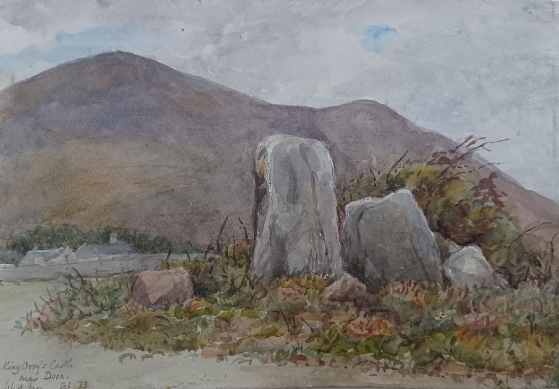
inscribed and dated "King Orrys Castle near Duon Isle of Man Sep 1873" and signed with initials "LWT"
Tom and Laura Taylor and thence by descent
Cashtal yn Ard Or King Orry’s Castle It’s not a castle, but a Neolithic long cairn dating to around 3000 BC.
This site is the largest known Megalithic tomb on the Isle of Man and is said to belong to King Orry, an almost legendary character revered by the Manx as their greatest king and founder of Mann. This mythical figure is based on King Godred Crovan, a Viking warrior who created the Kingdom of Mann and the Isles upon his arrival on the Island in 1079.
King Orry was credited for the introduction of the island's legal system and his arrival on the island is seen as the starting point of Manx history as we know it. He was also responsible for founding the Crovan dynasty, his descendants who ruled in Mann and the Isles for almost two centuries. At the site of his grave in Laxey, there are remains of two prehistoric chambered tombs: King Orry’s Grave, the largest cairn, is estimated to have been built during Neolithic times around 5000 years ago by farmers as memorials to their ancestors. Across the road is the other tomb. To find the site, follow the sign and path to find the stone circle which is behind a house. It is suggested that the two parts of the graves were connected to form three chambers encolsed by the cairn, but clear evidence for this has been complicated by the construction of the modern houses and roads. There are illustrated information boards at the site to provide more information about King Orry and the history and discovery of this tomb.
King Orry's Grave is the largest megalithic tomb on the Isle of Man. It is situated in Minorca, in the northern part of the village of Laxey, partly in a private cottage garden. It is some 4000 to 5000 years old; however the reference to King Orry is to the 11th century local ruler Godred Crovan, who has a number of supposed burial places. The modern name likely dates to the early 19th century.
King Orry's Grave is a Manx National Heritage site. The neolithic tomb comprises two separate chambered sections. Like Cashtal yn Ard, the structure is a multi-chambered Clyde cairn of coloured sandstone.The north-eastern facing eastern part of the tomb is semi-circular with a diameter of 12 m and a depth of 4 m. The eastern section is a row of three burial chambers covered by a trapezoidal-shaped cairn. A U-shaped forecourt and slab façade are linked by dry stone walls and two portal stones. The chamber may have been larger, but was destroyed in the 19th century during the construction of a road and a house.
At the western end there is a separate cist-like structure, excavated in 1930, with a menhir. As the central section is not extant, it is unclear whether this is part of the same structure as the construction of modern housing has made excavation difficult.The massive stone slabs that make up the chambers were of local stone. A second chamber was later built and at the south-west end, a horseshoe shaped forecourt was added. Only stumps of the original standing stones survive, except for one remaining tall stone. These standing stones likely formed part of a cairn of rubble that covered the burial chambers, similar to those found in the north of Ireland and south-west Scotland.
The island was cut off from the surrounding islands around 8000 BC as sea levels rose following the end of the last ice age. Humans colonised it by travelling by sea some time before 6500 BC. The first occupants were hunter-gatherers and fishermen. Examples of their tools are kept at the Manx Museum.
The Neolithic Period marked the beginning of farming, and the people began to build megalithic monuments, such as Cashtal yn Ard in Maughold parish, King Orry's Grave in Laxey, Mull Hill near Cregneash, and Ballaharra Stones at St John's. There were also the local Ronaldsway and Bann cultures. During the Bronze Age, the size of burial mounds decreased. The people put bodies into stone-lined graves with ornamental containers. The Bronze Age burial mounds survived as long-lasting markers around the countryside.
The ancient Romans knew of the island and called it Insula Manavia. During the four centuries when Rome ruled the Province of Britannia, the Roman military controlled the Irish Sea, providing safe passage of agricultural goods from the productive farms of Anglesey to Roman settlements at the English – Scottish frontier. Only a few Roman artifacts have been found on Mann, suggesting a lack of strategic value of Mann during the era of Britannia. No Roman lighthouses or signal towers have yet been found on Mann.
Around the 5th century AD, large-scale migration from Ireland precipitated a process of Gaelicisation, evidenced by Ogham inscriptions, and the Manx language developed. It is a Goidelic language closely related to Irish and Scottish Gaelic. In the 7th century, Mann came under control of the Anglo-Saxon King Edwin of Northumbria, who then launched raids from Mann into Ireland. How much influence the Northumbrians exerted on Mann is unknown, but very few place names on Mann are of Old English origin.
Vikings arrived at the end of the 8th century. They established Tynwald and introduced many land divisions that still exist. In 1266 King Magnus VI of Norway ceded the islands to Alexander III, King of Scots, in the Treaty of Perth. But Scottish rule over Mann did not become firmly established until 1275, when the Manx were defeated in the Battle of Ronaldsway, near Castletown.
In 1290 King Edward I of England sent Walter de Huntercombe to take possession of Mann. It remained in English hands until 1313, when Robert the Bruce took it after besieging Castle Rushen for five weeks. In 1314, it was retaken for the English by John Bacach of Argyll. In 1317, it was retaken for the Scots by Thomas Randolph, 1st Earl of Moray and Lord of the Isle of Man. It was held by the Scots until 1333. For some years thereafter control passed back and forth between the two kingdoms until the English took it for the final time in 1346. The English Crown delegated its rule of the island to a series of lords and magnates. Tynwald passed laws concerning the government of the island in all respects and had control over its finances but was subject to the approval of the Lord of Mann.
The Revestment occurred in 1765. In 1866, the Isle of Man obtained limited home rule, with partly democratic elections to the House of Keys, but the Legislative Council was appointed by the Crown. Since then, democratic government has been gradually extended. During both World Wars, the island was used for the internment of people originating from enemy countries. In recent times, the economy of the island has benefited from regulatory arbitrage in various contexts, such as low taxes, which have attracted wealthy individuals, and which together with arguably lax regulation have attracted industries such as offshore financial services and more recently gambling.
The Isle of Man has designated more than 250 historic sites as registered buildings. In Manx mythology, the island was ruled by the sea god Manannán, who would draw his misty cloak around the island to protect it from invaders. One of the principal folk theories about the origin of the name Mann is that it is named after Manannán.
In the Manx tradition of folklore, there are many stories of mythical creatures and characters. These include the Buggane, a malevolent spirit which according to legend, blew the roof off St Trinian's Church in a fit of rage; the Fenodyree; the Glashtyn; and the Moddey Dhoo, a ghostly black dog which wandered the walls and corridors of Peel Castle.
The Isle of Man is also said to be home to fairies, known locally as "the little folk" or "themselves". There is a famous Fairy Bridge, and it is said to be bad luck if one fails to wish the fairies good morning or afternoon when passing over it. It used to be a tradition to leave a coin on the bridge to ensure good luck. Other types of fairies include the Arkan Sonney.
An old Irish story tells how Lough Neagh was formed when Ireland's legendary giant Fionn mac Cumhaill (commonly anglicised to Finn McCool) ripped up a portion of the land and tossed it at a Scottish rival. He missed and the chunk of earth landed in the Irish Sea, thus creating the island.
Peel Castle has been proposed as a possible location of the Arthurian Avalon or as the location of the Grail Castle, site of Lancelot's encounter with the sword bridge of King Maleagant.
One of the most oft-repeated myths is that people found guilty of witchcraft were rolled down Slieau Whallian, a hill near St John's, in a barrel. However, this is a 19th-century legend derived from a Scottish legend, which in turn comes from a German legend. Separately, a witchcraft museum was opened at the Witches Mill, Castletown in 1951. There has never actually been a witches' coven on that site; the myth was only created with the opening of the museum. However, there has been a strong tradition of herbalism and the use of charms to prevent and cure illness and disease in people and animals.
Laura Wilson Barker (6 March 1819 – 22 May 1905), was a composer, performer and artist, sometimes also referred to as Laura Barker, Laura W Taylor or "Mrs Tom Taylor".
She was born in Thirkleby, North Yorkshire, third daughter of a clergyman, the Rev. Thomas Barker. She studied privately with Cipriani Potter and became an accomplished pianist and violinist. As a young girl Barker performed with both Louis Spohr and Paganini. She began composing in the mid-1830s - her Seven Romances for voice and guitar were published in 1837. From around 1843 until 1855 she taught music at York School for the Blind. During this period some of her compositions - including a symphony in manuscript, on 19 April 1845 - were performed at York Choral Society concerts.
On 19 June 1855 she married the English dramatist, critic, biographer, public servant, and editor of Punch magazine Tom Taylor. Barker contributed music to at least one of her husband's plays, an overture and entr'acte to Joan of Arc (1871), and provided harmonisations as an appendix to his translation of Ballads and Songs of Brittany (1865).
Her other works include the cantata Enone (1850), the violin sonata A Country Walk (1860), theatre music for As You Like It, (April 1880), Songs of Youth (1884), string quartets, madrigals and solo songs. Her choral setting of Keats's A Prophecy, composed in 1850, was performed for the first time 49 years later at the Hovingham Festival in 1899. The composer was present.
Several of Barker's paintings hang at Smallhythe Place in Kent, Ellen Terry's house.
Barker lived with her husband and family at 84 Lavender Sweep, Battersea. There were two children: the artist John Wycliffe Taylor (1859–1925), and Laura Lucy Arnold Taylor (1863–1940). The Sunday musical soirees at the house attracted many well-known attendees, including Lewis Carroll, Charles Dickens, Henry Irving, Charles Reade, Alfred Tennyson, Ellen Terry and William Makepeace Thackeray.
Tom Taylor died suddenly at his home in 1880 at the age of 62. After his death, his widow retired to Porch House, Coleshill in Buckinghamshire, where she died on 22 May 1905, aged 86.