" P Yates"
Unframed
The Isle of Skye is the largest and northernmost of the major islands in the Inner Hebrides of Scotland.The island's peninsulas radiate from a mountainous hub dominated by the Cuillin, the rocky slopes of which provide some of the most dramatic mountain scenery in the country. Although Sgitheanach has been suggested to describe a winged shape, no definitive agreement exists as to the name's origins.
The island has been occupied since the Mesolithic period, and over its history has been occupied at various times by Celtic tribes including the Picts and the Gaels, Scandinavian Vikings, and most notably the powerful integrated Norse-Gaels clans of MacLeod and MacDonald. The island was considered to be under Norwegian suzerainty until the 1266 Treaty of Perth, which transferred control over to Scotland. The 18th-century Jacobite risings led to the breaking-up of the clan system and later clearances that replaced entire communities with sheep farms, some of which involved forced emigrations to distant lands. Resident numbers declined from over 20,000 in the early 19th century to just under 9,000 by the closing decade of the 20th century. Skye's population increased by 4% between 1991 and 2001. About a third of the residents were Gaelic speakers in 2001, and although their numbers are in decline, this aspect of island culture remains important.
The main industries are tourism, agriculture, fishing, and forestry. Skye is part of the Highland Council local government area. The island's largest settlement is Portree, which is also its capital, known for its picturesque harbour. Links to various nearby islands by ferry are available, and since 1995, to the mainland by a road bridge. The climate is mild, wet, and windy. The abundant wildlife includes the golden eagle, red deer, and Atlantic salmon. The local flora is dominated by heather moor, and nationally important invertebrate populations live on the surrounding sea bed. Skye has provided the locations for various novels and feature films, and is celebrated in poetry and song.
The first written references to the island are Roman sources such as the Ravenna Cosmography, which refers to Scitis and Scetis, which can be found on a map by Ptolemy. One possible derivation comes from skitis, an early Celtic word for "winged", which may describe how the island's peninsulas radiate out from a mountainous centre. Subsequent Gaelic-, Norse- and English-speaking peoples have influenced the history of Skye; the relationships between their names for the island are not straightforward. Various etymologies have been proposed, such as the "winged isle" or "the notched isle", but no definitive solution has been found to date; the place name may be from an earlier, non-Gaelic language.
In the Norse sagas, Skye is called Skíð, for example in the Hákonar saga Hákonarsonar and a skaldic poem in the Heimskringla from around 1230 contains a line that translates as "the hunger battle-birds were filled in Skye with blood of foemen killed".The island was also referred to by the Norse as Skuy (misty isle),Skýey or Skuyö (isle of cloud). The traditional Gaelic name is An t-Eilean Sgitheanach (the island of Skye), An t-Eilean Sgiathanach being a more recent and less common spelling. In 1549, Donald Munro, High Dean of the Isles, wrote of "Sky": "This Ile is callit Ellan Skiannach in Irish, that is to say in Inglish the wyngit Ile, be reason it has mony wyngis and pointis lyand furth fra it, throw the dividing of thir foirsaid Lochis." but the meaning of this Gaelic name is unclear.
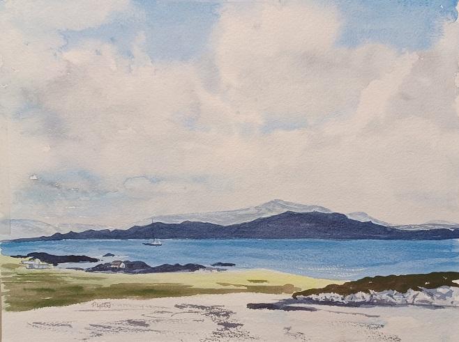
At 1,656 km2 (639 sq mi), Skye is the second-largest island in Scotland after Lewis and Harris. The coastline of Skye is a series of peninsulas and bays radiating out from a centre dominated by the Cuillin hills (Gaelic: An Cuiltheann). Malcolm Slesser suggested that its shape "sticks out of the west coast of northern Scotland like a lobster's claw ready to snap at the fish bone of Harris and Lewis" and W. H. Murray, commenting on its irregular coastline, stated, "Skye is 60 miles [100 km] long, but what might be its breadth is beyond the ingenuity of man to state".[1][Note 4] Martin Martin, a native of the island, reported on it at length in a 1703 publication. His geological observations included a note that:
There are marcasites black and white, resembling silver ore, near the village Sartle: there are likewise in the same place several stones, which in bigness, shape, &c., resemble nutmegs, and many rivulets here afford variegated stones of all colours. The Applesglen near Loch-Fallart has agate growing in it of different sizes and colours; some are green on the outside, some are of a pale sky colour, and they all strike fire as well as flint: I have one of them by me, which for shape and bigness is proper for a sword handle. Stones of a purple colour flow down the rivulets here after great rains.
The Black Cuillin, which are mainly composed of basalt and gabbro, include 12 Munros and provide some of the most dramatic and challenging mountain terrain in Scotland. The ascent of Sgùrr a' Ghreadaidh is one of the longest rock climbs in Britain and the Inaccessible Pinnacle is the only peak in Scotland that requires technical climbing skills to reach the summit. Nearby Sgùrr Alasdair, meanwhile, is the tallest mountain on any Scottish island. These hills make demands of the hill walker that exceed any others found in Scotland and a full traverse of the Cuillin ridge may take 15–20 hours. The Red Hills (Gaelic: Am Binnean Dearg) to the east are also known as the Red Cuillin. They are mainly composed of granite that has weathered into more rounded hills with many long scree slopes on their flanks. The highest point of these hills is Glamaig, one of only two Corbetts on Skye.
The northern peninsula of Trotternish is underlain by basalt, which provides relatively rich soils and a variety of unusual rock features. The Kilt Rock is named after the columnar structure of the 105-metre (344 ft) cliffs, said to resemble the pleats in a kilt. The Quiraing is a spectacular series of rock pinnacles on the eastern side of the main spine of the peninsula and further south is the rock pillar of the Old Man of Storr. The view of the Quiraing and the Old Man of Storr is one of the most iconic in all of Scotland, and is frequently used on calendars and tourism guides and brochures.
Beyond Loch Snizort to the west of Trotternish is the Waternish peninsula, which ends in Ardmore Point's double rock arch. Duirinish peninsula is separated from Waternish by Loch Dunvegan, which contains the island of Isay. It is ringed by sea cliffs that reach 296 metres (971 feet) on the west at Waterstein Head and on the northwest at Biod an Athair where, a metre from the summit trig pillar, the cliffs drop 1,029 feet (314 metres) to the ocean. Oolitic loam provides good arable land in the main valley. Lochs Bracadale and Harport and the island of Wiay lie between Duirinish and Minginish, which includes the narrower defiles of Talisker and Glen Brittle and whose beaches are formed from black basaltic sands. Strathaird is a relatively small peninsula close to the Cuillin hills with only a few crofting communities, the island of Soay lies offshore. The bedrock of Sleat in the south is Torridonian sandstone, which produces poor soils and boggy ground, although its lower elevations and relatively sheltered eastern shores enable a lush growth of hedgerows and crops. The islands of Raasay, Rona, Scalpay and Pabay all lie to the north and east between Skye and the mainland.
Portree in the north at the base of Trotternish is the largest settlement (estimated population 2,264 in 2011) and is the main service centre on the island. A December 2018 report recommended the village as "Skye's best home base" for visitors", since it has "a few hotels, hostels and bed-and-breakfasts in town, while more B&Bs line the roads into and out of town". The village also has "banks, churches, cafes and restaurants, a cinema at the Aros Centre, a swimming pool and library ... fuel filling stations and supermarkets".
Broadford, the location of the island's only airstrip, is on the east side of the island and Dunvegan in the north-west is well known for its castle and the nearby Three Chimneys restaurant. The 18th-century Stein Inn on the Waternish coast is the oldest pub on Skye. Kyleakin is linked to Kyle of Lochalsh on the mainland by the Skye Bridge, which spans the narrows of Loch Alsh. Uig, the port for ferries to the Outer Hebrides, is on the west of the Trotternish peninsula and Edinbane is between Dunvegan and Portree. Much of the rest of the population lives in crofting townships scattered around the coastline.
The most powerful clans on Skye in the post–Norse period were Clan MacLeod, originally based in Trotternish, and Clan Macdonald of Sleat. Following the disintegration of the Lordship of the Isles, Clan Mackinnon also emerged as an independent clan, whose substantial landholdings in Skye were centred on Strathaird.[67] Clan MacNeacail also have a long association with Trotternish,[68] and in the 16th century many of the MacInnes clan moved to Sleat.[69] The MacDonalds of South Uist were bitter rivals of the MacLeods, and an attempt by the former to murder church-goers at Trumpan in retaliation for a previous massacre on Eigg, resulted in the Battle of the Spoiling Dyke of 1578.
After the failure of the Jacobite rebellion of 1745, Flora MacDonald became famous for rescuing Prince Charles Edward Stuart from the Hanoverian troops. Although she was born on South Uist, her story is strongly associated with their escape via Skye, and she is buried at Kilmuir in Trotternish. Samuel Johnson and James Boswell's visit to Skye in 1773 and their meeting with Flora MacDonald in Kilmuir is recorded in Boswell's The Journal of a Tour to the Hebrides. Boswell wrote, "To see Dr Samuel Johnson, the great champion of the English Tories, salute Miss Flora MacDonald in the isle of Sky, [sic] was a striking sight; for though somewhat congenial in their notions, it was very improbable they should meet here". Johnson's words that Flora MacDonald was "A name that will be mentioned in history, and if courage and fidelity be virtues, mentioned with honour" are written on her gravestone. After this rebellion, the clan system was broken up and Skye became a series of landed estates.
I never was in any house of the islands, where I did not find books in more languages than one, if I staid long enough to want them, except one from which the family was removed. Literature is not neglected by the higher rank of the Hebrideans. It need not, I suppose, be mentioned, that in countries so little frequented as the islands, there are no houses where travellers are entertained for money. He that wanders about these wilds, either procures recommendations to those whose habitations lie near his way, or, when night and weariness come upon him, takes the chance of general hospitality. If he finds only a cottage he can expect little more than shelter; for the cottagers have little more for themselves but if his good fortune brings him to the residence of a gentleman, he will be glad of a storm to prolong his stay. There is, however, one inn by the sea-side at Sconsor, in Sky, where the post-office is kept.
Skye has a rich heritage of ancient monuments from this period. Dunvegan Castle has been the seat of Clan MacLeod since the 13th century. It contains the Fairy Flag and is reputed to have been inhabited by a single family for longer than any other house in Scotland. The 18th-century Armadale Castle, once home of Clan Donald of Sleat, was abandoned as a residence in 1925, but now hosts the Clan Donald Centre. Nearby are the ruins of two more MacDonald strongholds, Knock Castle, and Dunscaith Castle (called "Fortress of Shadows"), the legendary home of warrior woman, martial arts instructor (and, according to some sources, Queen) Scáthach. Caisteal Maol, a fortress built in the late 15th century near Kyleakin and once a seat of Clan MacKinnon, is another ruin.
In the late 18th century the harvesting of kelp became a significant activity, but from 1822 onward cheap imports led to a collapse of this industry throughout the Hebrides. During the 19th century, the inhabitants of Skye were also devastated by famine and Clearances. Thirty thousand people were evicted between 1840 and 1880 alone, many of them forced to emigrate to the New World. The "Battle of the Braes" involved a demonstration against a lack of access to land and the serving of eviction notices. The incident involved numerous crofters and about 50 police officers. This event was instrumental in the creation of the Napier Commission, which reported in 1884 on the situation in the Highlands. Disturbances continued until the passing of the 1886 Crofters' Act and on one occasion 400 marines were deployed on Skye to maintain order.The ruins of cleared villages can still be seen at Lorgill, Boreraig and Suisnish in Strath Swordale,and Tusdale on Minginish.