signed inscribed and dated
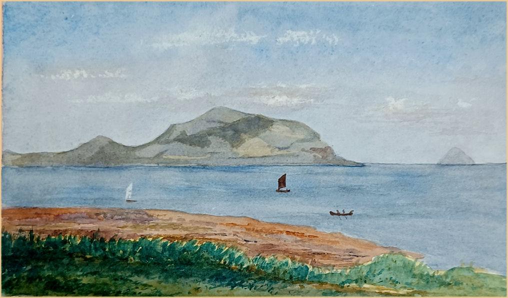
Ailsa Craig is an island of 99 hectares (240 acres) in the outer Firth of Clyde, 16 kilometres (8+1⁄2 nautical miles) west of mainland Scotland, upon which microgranite has long been quarried to make curling stones. The now-uninhabited island comprises the remains of a magmatic pluton formed during the same period of igneous activity as magmatic rocks on the nearby Isle of Arran. The island, colloquially known as "Paddy's milestone", was a haven for Catholics during the Scottish Reformation in the 16th century, but is today a bird sanctuary, providing a home for huge numbers of gannets and an increasing number of puffins.
An early reference to the rock is made by Sir Donald Monro, Archdeacon of the Isles, who referred to the rock as "Elsay" in the 16th century.The modern name of the island is an anglicisation of the Gaelic, Aillse Creag meaning "fairy rock". An alternative Gaelic name is Creag Ealasaid meaning "Elizabeth's rock". The first element, Aillse may represent Allt Shasann, "cliff of the English", mentioned in the Book of Leinster as Aldasain.
The island is sometimes known as "Paddy's Milestone", being approximately the halfway point of the sea journey from Belfast to Glasgow, a traditional route of emigration for many Irish labourers going to Scotland to seek work.
As a result of being the most conspicuous landmark in the channel between Ireland and Scotland, the island is known by a number of different names;
A' Chreag: "the rock"
Creag Alasdair: "Alasdair's rock"
Ealasaid a' Chuain: "Elizabeth of the ocean"
Alasan
Carraig Alasdair: "Alasdair's Rock" (used in the Madness of Sweeney, the tale of a legendary king of Ireland).
The Bass Rock is sometimes nicknamed "the Ailsa Craig of the East", although its prominence in the Firth of Forth is not as great as that of Ailsa Craig in the Firth of Clyde.
A number of features and places on the island have acquired names, Gaelic in most cases, such as Craigna'an (cliff of birds); Trammins (place of Elder trees); Balvar (big round cliff); Garryloo (rough hill) and Ashydoo (black hill). Some names seem self-explanatory and indeed even the 'Swine Cave' may refer to a time when the Earl of Cassilis received part of his rent in hogs from the island.
In 1590 the shipping of the Clyde was disrupted by pirates who were said to be Highlanders, quha lyis about Ailsay.
In 1831, The 12th Earl of Cassilis became first Marquess of Ailsa, taking the title from the Craig, which was his property.
An annual hunt of the solan geese or gannets took place in the days of Robert Burns as the flesh was considered a delicacy. Robert Burns's maternal uncle Samuel Burns was involved in the solan goose trade.
The 12-metre (39 ft) high ruins of a 3-storey castle that stands on the eastern side of the island was built in the late 1500s by the Hamilton Family to protect the island from King Philip II of Spain. The island was used as a prison during the 18th and 19th centuries. The castle has two vaulted storeys and an oven is located in a cellar with evidence of a spiral stairway that once ran to the top of the tower. Three cinquefoils arranged in a 'V' shape are carved on the tower and indicate that the Hamiltons were linked with the structure. There are indications of an adjoining building that ran to the north.
Ailsa Craig was a haven for Roman Catholics during the Scottish Reformation. In about 1587 the prominent Catholic, Lord Maxwell, landed on Ailsa while attempting to escape his pursuers and finding a fishing boat he attempted to reach Crossraguel Abbey, but was captured. In 1597 another Catholic supporter, Hugh Barclay of Ladyland, took possession of Ailsa Craig which he was intent on using as a place of safety for Catholics to practise their faith, for provisioning and stopping off point for a Spanish invasion which would re-establish the Catholic faith in Scotland and a storehouse for provisioning the Catholic Earl of Tyrone in Ireland.
Hugh was however discovered by The Rev. Andrew Knox, a Protestant minister (who later became both Lord Bishop of the Isles and Lord Bishop of Raphoe). Barclay thereafter deliberately drowned himself in the sea or did so accidentally whilst trying to escape. Another version states that Andrew Knox lay in wait for Hugh with nineteen others and ambushed him at the shingle beach with the result that he attempted to defend himself until he was forced back into the sea and drowned.
Beneath the Main Craig at the southern end of the island and 40 ft (12m) above sea level is a cave named after the supposed smuggler MacNall. When the cave was being cleared of guano many years ago, two stone coffins were found, both containing human bones. The Rev. Roderick Lawson (1831–1907) thought that one of the interments might be MacNall himself, but no details of this individual have yet come to light. Ailsa Craig would have been an ideal place for the temporary hiding of contraband goods.
The island had two chapels and Thomas Pennant who visited Ailsa Craig in 1772 recorded that the ruins of a small chapel were located near the landing place and that another chapel (which he did not visit) was located on the summit of the island and was probably used by seamen to pray for safe voyages and returns. Lawson sees this second chapel as being a myth.[49] When the lighthouse was being constructed, four stone coffins were found that may well have been associated with the first mentioned chapel, two at the tenant's house and two at the gasholder site. The monks of Crossraguel Abbey once held the island and "places of prayer" are therefore to be expected especially with a garrisoned castle nearby; it is to be noted that even the diminutive Lady Isle off Troon once had a chapel. The chapel was first mentioned, along with the castle, in 1580 by Sir James Balfour.
The Lighthouse was built between 1883 and 1886 by Thomas Stevenson; it is owned by the Northern Lighthouse Board.
The lighthouse was automated in 1990 and converted to solar electric power in 2001; the island has been uninhabited since automation in 1990. Ailsa Craig and its lighthouse feature extensively in Peter Hill's book Stargazing: Memoirs of a Young Lighthouse Keeper.
Two substantial foghorns with concrete housings were built in 1866, one at the north end of the island near the Swine Cave reached by 'the Loups' path[53] and the other at East Trammins on the south end. Both were powered by compressed air that was piped from the lighthouse, where a gas-powered compressor was housed until 1911 when oil-powered engines were installed. One of the compressed air pipelines can still be seen within 'the Loups' path that was constructed above it. The compressed air cylinders that held the required store of air are still prominent features, especially at the Trammins foghorn. Both foghorns were decommissioned in 1966 and a Tyfon fog signal was used until 1987 when improvements in ship navigation made it also redundant.
The gasworks are still a prominent feature on the island and the cable-powered tramway was partly built to haul wagons full of coal up to it from the North Port. Two gasholders held the coal gas that powered both the compressed air pump and the lighthouse light, however in 1911 the light was converted to incandescent lighting which was powered by electricity. The gas works became redundant at this time. Lawson records that oil was used to produce the gas for the lighthouse light.
Ailsa Craig had two quite separate rail transport systems, one dated from 1886 and supplied coal, oil fuel and provisions to the lighthouse and gas works via the North Port and later the New Jetty and the other transported road stone from the quarries at Kennedy's Nags via the stone crusher to the Quarry Pier. The Northern Lighthouse Board's tramway had a section worked via a powered cableway that hauled wagons up from the North Port and later from the new jetty.
This well-built tram line is largely intact and has a gauge of three feet with junction/points at the gas works and a further set of points that led to a siding that ran down parallel to the gable end of the gas works to presumably collect the coal ash for disposal. The main line runs on down to the lighthouse and its ancillary buildings, taking a right-angled bend to run parallel to the southern end of the lighthouse buildings block.This section of the line was worked by hand and at least two wagons remain at the site together with a set of spare wheels at the gas works.
The mineral line was built by the Ailsa Craig Granite Company Ltd. in 1909 and ran from the quarry at Kennedy's Nags via the stone crusher near the south foghorn to the Quarry Pier.[59] This crudely constructed narrow gauge line was mainly horse drawn, although wagons were also moved by hand or hauled up inclines by winding engines. The mineral railway at the quarry end had a least one siding and a mobile steam crane loaded the larger granite blocks into the wagons that were transported to the stone crusher at the Trammins near the south foghorn, smaller stones being loaded and even moved by hand.
Wagons or bogies were winched up to the substantial stone crusher and gravity was used to deliver the different grades of road stone to the waggons below that were then hauled by horses to the Quarry Pier via a line that ran in front of the lighthouse buildings and took a tight right-angled bend to run up the substantial stone-built incline to the storage area in preparation for delivery via sea to the mainland.Kerb stones and stone railway sleepers for sections of the Scotch gauge horse-drawn railway from Ardrossan to Doura were also produced.
Photographs taken in the late 19th century show the horse-drawn wagons passing in front of the lighthouse and portray the substantial railway incline and storage area. At times the production outstripped the storage capacity and a photograph shows at least three piles of different grades of road stone stockpiled in front of the lighthouse enclosure. The track at the crusher had a siding that ran to the crusher and a set of points that led to the Quarry Pier main line.
The Ailsa Craig Granite Company was never a financially sound business and effectively closed in 1928. The course of the mineral line is still evident near the quarries as a linear embankment that ends below Kennedy's Nag. Various artefacts of the quarry enterprise remain, including concrete blocks at Kennedy's Nag and steel and concrete remnants of the stone crusher near the south foghorn.
From the mid-nineteenth century the island has been quarried for its rare type of micro-granite with riebeckite (known as "Ailsite"), which is used to make stones for the sport of curling. As of 2004, 60–70% of all curling stones in use were made from granite from the island and it is one of only two sources for all stones in the sport, the other being the Trefor Granite Quarry in Wales.
Ailsa Craig produced two types of granite for curling, Blue Hone and Ailsa Craig Common Green. Blue Hone, which is unique to Ailsa Craig, has very low water absorption, which prevents the action of repeatedly freezing water from eroding the stone. Ailsa Craig Common Green is a lesser quality granite than Blue Hone. In the past, most curling stones were made from Blue Hone but the quarry is restricted by environmental conditions that exclude blasting.
Kays of Scotland has been making curling stones since 1851 and has the exclusive rights to the Ailsa Craig granite, granted by the Marquess of Ailsa. A "harvest" of Ailsa Craig granite by Kays took place in 2013, after a hiatus of 11 years; 2,000 tonnes were harvested, sufficient to fill anticipated orders until at least 2020. A subsequent harvest was held in the winter of 2020.
Sea eagles or erne nested at the Bare Stack until 1881 when the tenant shot the last specimen, which is preserved at Culzean Castle.
Pennant and others have noted that the only trees growing on the island are elders (Sambucus nigra) or bourtrees in the Scots dialect, found as a grove known as The Bourtrees at the Trammins on the southern end of the island.[68] This visitor also rather quaintly mentions that he was surprised to find three species of "reptiles" by which he meant molluscs, namely a naked black slug, the garden snail Cornu aspersum and one of the common striped snails of the genus Cepaea. He speculated that they had accidentally been brought over from the mainland secreted within vegetables.
Slowworms (Anguis fragilis) are found on the island, although they suffered greatly when badgers and raccoons were introduced by Lord Ailsa. The badgers did not survive long, but the racoons bred for a number of years.The mammal fauna included rabbits, and at one time goats, whilst pigs were bred here as food for the inhabitants. The billy goats were shot for sport in the 19th century and no longer survive; only a mounted head of one remains at the McKechnie Institute in Girvan. The rabbits and goats may have been originally introduced to supply food for the fishermen and were mentioned by Pennant in 1772 and by the Rev Abercummie in 1688, who called them by the old name of coneys.
The island is now a bird sanctuary, leased by the RSPB until 2050. Huge numbers of gannets nest here.
Rats were probably introduced via shipwrecks; supposedly, a coal boat that sank offshore was the first culprit and caused great harm to the nesting bird populations, with the puffins proving vulnerable to the extent of extinction as breeding birds. After a long campaign using pioneering techniques, the rats were eradicated in 1991, and now puffins are once again raising young on the island with many other benefits accruing to both the fauna and the flora.In a small glen above Ailsa Castle, a small freshwater body known as the Garry Loch is located at an altitude of 247 metres (810 ft),[76] with a depth of at least 17 feet.