" P Yates" and inscribed on the reverse
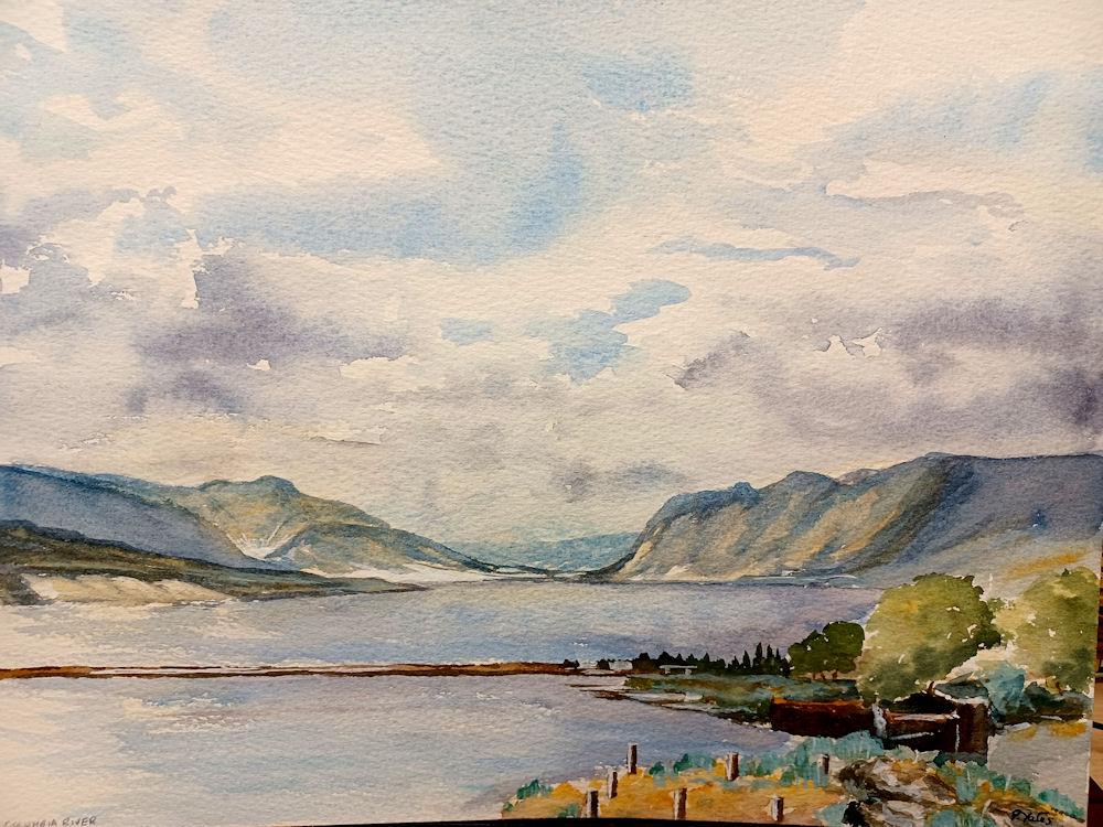
The Columbia River (Upper Chinook: Wimahl or Wimal; Sahaptin: Nch’i-Wàna or Nchi wana; Sinixt dialect swah'netk'qhu) is the largest river in the Pacific Northwest region of North America.The river rises in the Rocky Mountains of British Columbia, Canada. It flows northwest and then south into the U.S. state of Washington, then turns west to form most of the border between Washington and the state of Oregon before emptying into the Pacific Ocean. The river is 1,243 miles (2,000 km) long, and its largest tributary is the Snake River. Its drainage basin is roughly the size of France and extends into seven US states and a Canadian province. The fourth-largest river in the United States by volume,[note 1] the Columbia has the greatest flow of any North American river entering the Pacific. The Columbia has the 36th greatest discharge of any river in the world.
The Columbia and its tributaries have been central to the region's culture and economy for thousands of years. They have been used for transportation since ancient times, linking the region's many cultural groups. The river system hosts many species of anadromous fish, which migrate between freshwater habitats and the saline waters of the Pacific Ocean. These fish—especially the salmon species—provided the core subsistence for native peoples.
The first documented European discovery of the Columbia River occurred when Bruno de Heceta sighted the river's mouth in 1775. In the late 18th century, a private American ship became the first non-indigenous vessel to enter the river; in 1792 William Robert Broughton of the British Royal Navy navigated past the Oregon Coast Range into the Willamette Valley. In the following decades, fur-trading companies used the Columbia as a key transportation route. Overland explorers entered the Willamette Valley through the scenic but treacherous Columbia River Gorge, and pioneers began to settle the valley in increasing numbers. Steamships along the river linked communities and facilitated trade; the arrival of railroads in the late 19th century, many running along the river, supplemented these links.
Since the late 19th century, public and private sectors have extensively developed the river. To aid ship and barge navigation, locks have been built along the lower Columbia and its tributaries, and dredging has opened, maintained, and enlarged shipping channels. Since the early 20th century, dams have been built across the river for power generation, navigation, irrigation, and flood control. The 14 hydroelectric dams on the Columbia's main stem and many more on its tributaries produce more than 44 percent of total U.S. hydroelectric generation. Production of nuclear power has taken place at two sites along the river. Plutonium for nuclear weapons was produced for decades at the Hanford Site, which is now the most contaminated nuclear site in the United States. These developments have greatly altered river environments in the watershed, mainly through industrial pollution and barriers to fish migration.
The Columbia makes a sharp bend to the west at the Washington–Oregon border. The river defines that border for the final 309 miles (497 km) of its journey. The Deschutes River joins the Columbia near The Dalles. Between The Dalles and Portland, the river cuts through the Cascade Range, forming the dramatic Columbia River Gorge. No other rivers except for the Klamath and Pit River completely breach the Cascades—the other rivers that flow through the range also originate in or very near the mountains. The headwaters and upper course of the Pit River are on the Modoc Plateau; downstream the Pit cuts a canyon through the southern reaches of the Cascades. In contrast, the Columbia cuts through the range nearly a thousand miles from its source in the Rocky Mountains. The gorge is known for its strong and steady winds, scenic beauty, and its role as an important transportation link. The river continues west, bending sharply to the north-northwest near Portland and Vancouver, Washington, at the Willamette River confluence. Here the river slows considerably, dropping sediment that might otherwise form a river delta. Near Longview, Washington and the Cowlitz River confluence, the river turns west again. The Columbia empties into the Pacific Ocean just west of Astoria, Oregon, over the Columbia Bar, a shifting sandbar that makes the river's mouth one of the most hazardous stretches of water to navigate in the world. Because of the danger and the many shipwrecks near the mouth, it acquired a reputation as the "Graveyard of Ships".[
The Columbia drains an area of about 258,000 square miles (670,000 km2). Its drainage basin covers nearly all of Idaho, large portions of British Columbia, Oregon, and Washington, ultimately all of Montana west of the Continental Divide, and small portions of Wyoming, Utah, and Nevada; the total area is similar to the size of France. Roughly 745 miles (1,200 km) of the river's length and 85 percent of its drainage basin are in the US. The Columbia is the twelfth-longest river and has the sixth-largest drainage basin in the United States. In Canada, where the Columbia flows for 498 miles (801 km) and drains 39,700 square miles (103,000 km2), the river ranks 23rd in length, and the Canadian part of its basin ranks 13th in size among Canadian basins. The Columbia shares its name with nearby places, such as British Columbia, as well as with landforms and bodies of water.
The Chinook tribe, which is not federally recognized, who live near the lower Columbia River, call it Wimahl or Wimal in the Upper Chinook (Kiksht) language, and it is Nch’i-Wàna or Nchi wana to the Sahaptin (Ichishkíin Sɨ́nwit)-speaking peoples of its middle course in present-day Washington. The river is known as swah'netk'qhu by the Sinixt people, who live in the area of the Arrow Lakes in the river's upper reaches in Canada. All three terms essentially mean "the big river".
Oral histories describe the formation and destruction of the Bridge of the Gods, a land bridge that connected the Oregon and Washington sides of the river in the Columbia River Gorge. The bridge, which aligns with geological records of the Bonneville Slide, was described in some stories as the result of a battle between gods, represented by Mount Adams and Mount Hood, in their competition for the affection of a goddess, represented by Mount St. Helens. Native American stories about the bridge differ in their details but agree in general that the bridge permitted increased interaction between tribes on the north and south sides of the river.
Horses, originally acquired from Spanish New Mexico, spread widely via native trade networks, reaching the Shoshone of the Snake River Plain by 1700. The Nez Perce, Cayuse, and Flathead people acquired their first horses around 1730. Along with horses came aspects of the emerging plains culture, such as equestrian and horse training skills, greatly increased mobility, hunting efficiency, trade over long distances, intensified warfare, the linking of wealth and prestige to horses and war, and the rise of large and powerful tribal confederacies. The Nez Perce and Cayuse kept large herds and made annual long-distance trips to the Great Plains for bison hunting, adopted the plains culture to a significant degree, and became the main conduit through which horses and the plains culture diffused into the Columbia River region. Other peoples acquired horses and aspects of the plains culture unevenly. The Yakama, Umatilla, Palus, Spokane, and Coeur d'Alene maintained sizable herds of horses and adopted some of the plains cultural characteristics, but fishing and fish-related economies remained important. Less affected groups included the Molala, Klickitat, Wenatchi, Okanagan, and Sinkiuse-Columbia peoples, who owned small numbers of horses and adopted few plains culture features. Some groups remained essentially unaffected, such as the Sanpoil and Nespelem people, whose culture remained centered on fishing.
Natives of the region encountered foreigners at several times and places during the 18th and 19th centuries. European and American vessels explored the coastal area around the mouth of the river in the late 18th century, trading with local natives. The contact would prove devastating to the Indian tribes; a large portion of their population was wiped out by a smallpox epidemic. Canadian explorer Alexander Mackenzie crossed what is now interior British Columbia in 1793. From 1805 to 1807, the Lewis and Clark Expedition entered the Oregon Country along the Clearwater and Snake rivers, and encountered numerous small settlements of natives. Their records recount tales of hospitable traders who were not above stealing small items from the visitors. They also noted brass teakettles, a British musket, and other artifacts that had been obtained in trade with coastal tribes. From the earliest contact with westerners, the natives of the mid- and lower Columbia were not tribal, but instead congregated in social units no larger than a village, and more often at a family level; these units would shift with the season as people moved about, following the salmon catch up and down the river's tributaries.
Sparked by the 1847 Whitman Massacre, a number of violent battles were fought between American settlers and the region's natives. The subsequent Indian Wars, especially the Yakima War, decimated the native population and removed much land from native control. As years progressed, the right of natives to fish along the Columbia became the central issue of contention with the states, commercial fishers, and private property owners. The US Supreme Court upheld fishing rights in landmark cases in 1905 and 1918, as well as the 1974 case United States v. Washington, commonly called the Boldt Decision.
Four men dressed in long-sleeved shirts, long pants, and hats are perched on platforms on both sides of a rushing stream. Three of the men are standing, and one is seated. Each man holds one end of a long pole with a net, dipped in the water, attached to the other end. Several people without poles are watching or waiting nearby.
Fish were central to the culture of the region's natives, both as sustenance and as part of their religious beliefs. Natives drew fish from the Columbia at several major sites, which also served as trading posts. Celilo Falls, located east of the modern city of The Dalles, was a vital hub for trade and the interaction of different cultural groups,[56] being used for fishing and trading for 11,000 years. Prior to contact with westerners, villages along this 9-mile (14 km) stretch may have at times had a population as great as 10,000.[61] The site drew traders from as far away as the Great Plains.
The Cascades Rapids of the Columbia River Gorge, and Kettle Falls and Priest Rapids in eastern Washington, were also major fishing and trading sites.
In prehistoric times the Columbia's salmon and steelhead runs numbered an estimated annual average of 10 to 16 million fish. In comparison, the largest run since 1938 was in 1986, with 3.2 million fish entering the Columbia. The annual catch by natives has been estimated at 42 million pounds (19,000 t). The most important and productive native fishing site was located at Celilo Falls, which was perhaps the most productive inland fishing site in North America.] The falls were located at the border between Chinookan- and Sahaptian-speaking peoples and served as the center of an extensive trading network across the Pacific Plateau. Celilo was the oldest continuously inhabited community on the North American continent.
Salmon canneries established by white settlers beginning in 1866 had a strong negative impact on the salmon population, and in 1908 US President Theodore Roosevelt observed that the salmon runs were but a fraction of what they had been 25 years prior.
As river development continued in the 20th century, each of these major fishing sites was flooded by a dam, beginning with Cascades Rapids in 1938. The development was accompanied by extensive negotiations between natives and US government agencies. The Confederated Tribes of Warm Springs, a coalition of various tribes, adopted a constitution and incorporated after the 1938 completion of the Bonneville Dam flooded Cascades Rapids; Still, in the 1930s, there were natives who lived along the river and fished year round, moving along with the fish's migration patterns throughout the seasons. The Yakama were slower to do so, organizing a formal government in 1944. In the 21st century, the Yakama, Nez Perce, Umatilla, and Warm Springs tribes all have treaty fishing rights along the Columbia and its tributaries.
In 1957 Celilo Falls was submerged by the construction of The Dalles Dam, and the native fishing community was displaced. The affected tribes received a $26.8 million settlement for the loss of Celilo and other fishing sites submerged by The Dalles Dam. The Confederated Tribes of Warm Springs used part of its $4 million settlement to establish the Kah-Nee-Ta resort south of Mount Hood.