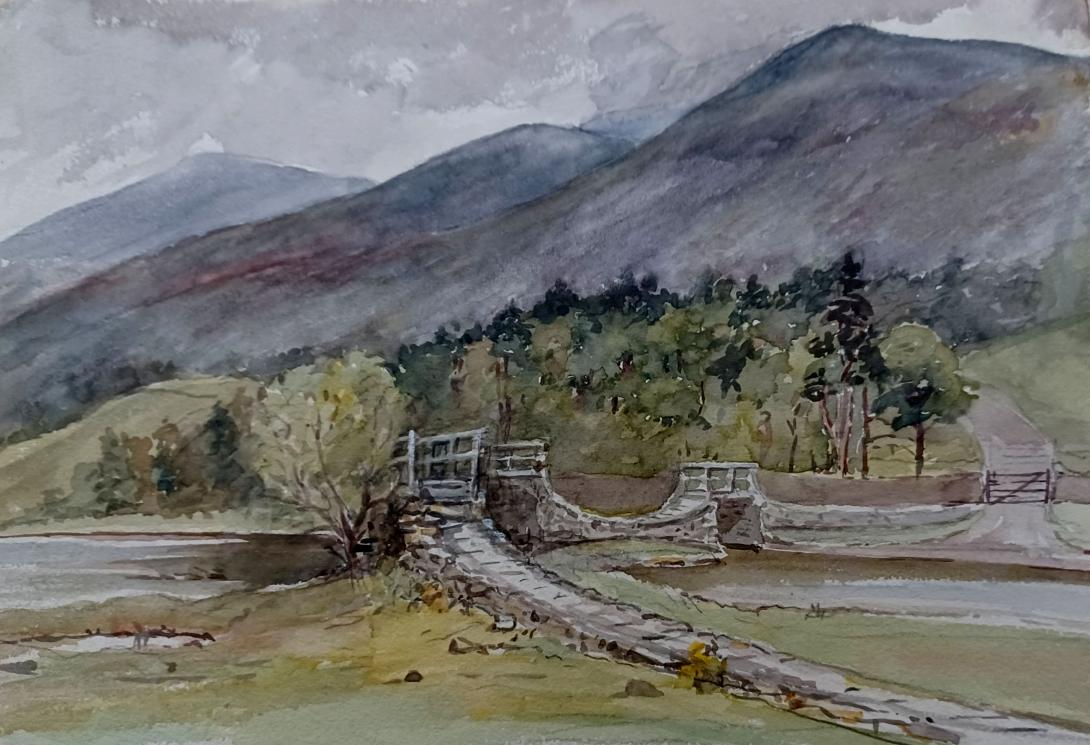
inscribed and dated "The Bridge Thirlmere part of the Helvellyn Range Jun 29 1875" and sigend with initials "LWT"
Tom and Laura Taylor and thence by descent
The Helvellyn range is the name given to a part of the Eastern Fells in the English Lake District, "fell" being the local word for "hill". The name comes from Helvellyn, the highest summit of the group.
The Helvellyn range forms a ridge extending for about 10 km, at no point dropping below 600 m. The ridge runs in a north–south direction, with Patterdale on the eastern side and the Thirlmere valley to the west. The village of Threlkeld lies directly to the north, below the northernmost point on the ridge, Clough Head.
Generally, the slopes above Thirlmere are steep and grassy, whilst the Patterdale side exhibits rockier features, due to cirque glaciation on the north east side of the ridge. South of Dollywaggon Pike the land drops to a height of 574 m by the side of Grisedale Tarn at the head of Grisedale, before rising again to Seat Sandal. Dollywaggon Pike is usually considered to mark the southernmost peak of the Helvellyn range, although the term is sometimes used more broadly to include Fairfield and the other peaks north of Ambleside.
In 1879, the Manchester Corporation obtained royal permission to turn Thirlmere into a reservoir by building a dam that would flood the valley, drowning the hamlets of Wythburn and Armboth and submerging a shoreline rich in beauty and folklore. I climb Raven Crag and Launchy Gill in search of the ghosts of a lost world.
Frost has iced the earth, feathering treetops in elegant plumes of winter. Above a lake of shadows, Raven Crag stands proud, mirrored in waters blue as midnight, its chiselled face furred with conifer. Not that anyone left alive remembers, but it once stood taller:
“Farewell! the dear irrevocable shore!
Dark firs, and blue-bell copse, and shallowing bright!
Stern Raven Crag is cheated of its height”The words are Canon Hardwicke Drummond Rawnsley’s, lamenting a Victorian act of vandalism wrought on this ancient landscape by the construction of the stone dam beneath my feet. He was not alone in his anger: W. G. Collingwood, founder of the Ruskin museum and designer of the Great Gable war memorial, declared, “Thirlmere… once was the richest in story and scenery of all the lakes. The old charm of its shores has quite vanished, and the sites of its legends are hopelessly altered, so that the walk along either side is a mere sorrow to anyone who cared for it before; the sham castles are an outrage and the formality of the roads, beloved of cyclists, deforms the hillsides like a scar on a face”. Ruskin himself was less generous, saying of the dam builders, “as to these Manchester robbers … there is ‘no profit’ in the continuance of their lives”.
The “robbers” were the Waterworks Committee of the Manchester Corporation. In 1877, they published a report predicting that Manchester would outgrow its current water supply within seven years—this in spite of municipal policies that discouraged water closets and baths in working class homes. They proposed a scheme to turn Thirlmere into a reservoir that would supply Manchester with fifty million gallons of water per day by means of a ninety-six-mile-long aqueduct. It would be an innovative triumph of engineering, and it would provide the city (and its cotton mills) with some of the purest water to be found anywhere in England.
To obtain the powers necessary, a private bill was brought before Parliament. The corporation had anticipated the kind of objections that were raised by wealthy landowners (such as, “undesirable disturbance by constructing the aqueduct through gentlemen’s private pleasure grounds”). They had even whipped up local support—when petitioned the ratepayers of Keswick voted 90% in favour (they’d been promised the scheme would free the town from flooding forever). But Manchester had underestimated the weight of opposition from another quarter.
Social reformer, Octavia Hill, called for a committee to examine the matter, devise a plan of opposition, and raise funds to fight the scheme. Under a name more evocative of a paramilitary force than a village green preservation society, the Thirlmere Defence Association was born. It was a coalition of creatives, including eminent writers, artists and philosophers.
The debating of a private bill is designed to consider objections from those who will be financially disadvantaged by its proposal. Unable to demonstrate any such private interest, the TDA presented the landscape as a public asset and its despoliation as an affront to the nation. Their argument was sufficiently strong, and whipped up enough public support, to commute the private bill into a hybrid bill, which considered the public as well as private interests.
The Defence Association was particularly incensed by Alderman Grave’s assertion that the scheme would improve on nature. John Grave actually had closer ties with the area than many of his opponents, being the son of a Cockermouth saddler. He had moved to Manchester to found a highly successful paper manufacturing business and had become mayor three times. He was now chairman of the Waterworks Committee—converting Thirlmere into a reservoir had been his brainchild.
Lord of the Manor, Thomas Leonard Stanger Leathes of Dale Head Hall, on the eastern shore, was outraged; he banned anyone associated with the scheme from his land. As a result, Grave and Sir John James Haywood had to conduct a clandestine survey, on hands and knees in appalling weather to avoid forcible ejection. As a consequence, they both spent several days in bed with severe colds.
But Leathes died in 1877, and the Manchester Corporation bought his estate. Despite spirited opposition, Parliament found in favour of Grave’s committee, and in 1879, the Corporation was granted royal permission by Queen Victoria to begin work; the first stone of the dam was laid in 1890. It would eventually raise the level of the lake by 54ft and increase its expanse to 690 acres, submerging the cottages and farmsteads of Wythburn and Armboth, and transforming the valley forever.
The Thirlmere Defence Association had lost the battle but not the war. It inspired the formation of the National Trust and was iconic in the development of modern environmental protection—it was, essentially, the birth of the Green movement in Britain.
Grave died in 1891, three years before the water supply was switched on, but not before the Cumbrian landscape had exacted a degree of poetic justice. With the scheme underway, Grave retired to Portinscale where he built a grand residence, the Towers. In a headstrong rush of pride, Grave augmented his property with an ostentatious gothic coach house, sporting steeples and cloisters. Locals warned him that the ground between the lake and road was too moist to support such a thing. When he refused to listen, they termed the building, “Grave’s folly”; and such it turned out to be. In a scenario reminiscent of a Monty Python sketch, it “sunk into the swamp”.
I walk on past one of the faux castles that so enraged Collingwood. They were built by the Manchester Corporation to house the dam’s workings—Grave’s vision of enhancing the landscape, no doubt.
Some people felt that the greater affront was the Corporation’s aggressive afforestation policy, replacing the thin skirt of indigenous oaks that lined the lake with dense spruce and larch plantations. The aim was to filter run-off water from the fells and preserve the lake’s purity, but the dense cover obscured magnificent vistas and gave Thirlmere a look more in keeping with Canada than the heart of the English Lake District.
These days, the prospect is changing. Even before handing stewardship to the Water Board, the Manchester Corporation had adopted more sensitive policies, thinning the conifer and planting broad-leaf tree varieties. As I climb through the woods, a clearing reveals the bay-dun majesty of Helvellyn and the Dodds, and splashes of deciduous shrub lick sombre greens with flames of autumnal copper. Ahead the larches are not without their charms. Unique among conifers in shedding the needles, their stark winter forms adorn the mossy terraces and vertical white walls of Raven Crag. Their perpendicular trunks are slender pillars, and their bare branches, rib vaults to a succession of rock galleries, enhancing the stately grandeur of this immense natural cathedral.
The path tracks uphill beside the cliff to the old iron age fort of Castle Crag. From here, I climb to Raven Crag’s summit from behind by means of a wooden boardwalk. The top commands a peerless view down the entire length of the lake. This is the spot where Wainwright sketched himself, “apparently contemplating the view (but more likely merely wondering if it’s time to be eating his sandwiches)”.
Edward Baines, writing in 1834, helps us imagine what all this looked like in the pre-Manchester days:
“Before us, and lying along the foot of the fells, which separate this valley from that of Watendlath, stretched the dark, narrow lake of Thirlmere, which bears also the names of Leathes Water and Wythburn Water. It is nearly three miles in length, but about the middle the shores approach each other so as almost to divide it into two distinct lakes, —a bridge being thrown over the strait. It is overhung and shaded by crags, some of which are stupendous, and all naked and gloomy. The most conspicuous is Raven-crag, near the foot of the lake, which forms a striking object for many miles,—resembling a gigantic round tower, blackened and shattered by the lapse of ages. Thirlmere has a higher elevation than any other lake, being 500 feet above the level of the sea: its greatest depth of water is eighteen fathoms. Its borders are not adorned, like those of the other lakes, by wood, with the exception of a few fir plantations, (which rather increase the gloominess of the scene), and of a bold wooded eminence, called the How, at the foot of the lake. This valley has no luxuriance, and its general character is wild magnificence.”
(It was Thirlmere’s elevation that proved so attractive to the Manchester Corporation. Few other English lakes could have fed the aqueduct by gravity alone.)
Harriet Martineau, in 1855, adds to the picture:
“Of the two lake-roads, the rude western one is unquestionably the finest. The woods, which were once so thick that the squirrel is said to have gone from Wythburn to Keswick without touching the ground, are cleared away now; and the only gloom in the scene is from the mass of Helvellyn. The stranger leaves the mail road within a mile of the Horse’s Head, passes the cottages called by the boastful name of the City of Wythburn, and a few farmhouses, and soon emerging from the fences, finds himself on a grassy level under the Armboth Fells, within an amphitheatre of rocks, with the lake before him, and Helvellyn beyond, overshadowing it. The rocks behind are feathered with wood, except where a bold crag here, and a cataract there, introduces a variety.”
This old road has been lost beneath the waters, along with its landmarks, rich in stories. Submerged is Clark’s Lowp, a huge boulder opposite Deergarth How Island, from which Clark, a henpecked dalesman made mortally miserable by the nagging of his wife, sought peace by launching himself into the water and drowning. His wife apparently remarked with indifference, “he had often threatened to do away with himself, but I never thought the fool would find the courage to do such a thing”.
Where Launchy Gill crossed the old road was the Steading Stone. Here, the manorial courts were held and the Pains and Penalties of Wythburn were exacted. The penalties included fines for allowing more than your allotted number of sheep to graze the fell or letting cattle wander and foul the becks. (Years later, Wainwright was rumoured to have fouled the becks in protest at “the dark forests (that) conceal the dying traces of a lost civilisation, lost not so very long ago.”
Many of these legends are woven into Hall Caine’s novel, The Shadow of a Crime, published in 1885. Caine grew up in Runcorn but his mother was Cumbrian, and while his story is a fiction, the book is steeped in local heritage. Set just after the English Civil War, it tells the story of Ralph Ray, an honest dalesman, who won respect fighting in the republican army. Times are changing, however, and with Cromwell in the grave and Charles II on the throne, opinion is turning against former Roundheads. Ralph saved the life of a turncoat royalist soldier, James Wilson, and brought him home to Wythburn to work on his father’s farm; but his father suspects Wilson is a snake-in-the-grass. When Wilson is found dead, suspicion falls on an impoverished tailor, called Simeon Stagg. There is insufficient evidence to convict Stagg and he walks free, but the community, convinced of his guilt and fearful of divine wrath should they knowingly shelter a murderer, drive him out, forcing him to live in a cave on the slopes above Fornside.
Ray and Wilson are Caine’s inventions but the story of Sim’s cave and the “hang-gallows tailor” are a genuine part of the valley’s folklore. He allegedly murdered a traveller on the eastern shore road near the Nag’s Head tavern that once stood opposite Wythburn Church. Sim is said to have eventually left the area when the hardships of cave-dwelling became too much.
In Caine’s version, however, Sim is innocent. He knows what really happened that night but refuses to tell as the truth would harm Ralph, his only friend. Not even Sim knows the whole story, however. That only emerges when another villager is stricken with The Plague and resolves to die with a clear conscience.
The Great Plague of 1665 was a genuine concern for the residents of Wythburn and Armboth (as it was for many other Cumbrian villages). At its height, movement around the District was restricted, but livings still had to be made. Up above Launchy Tarn, at a confluence of paths, is the Web Stone, a boulder where webs of wool would be covertly traded well away from the villages. Coins were washed in vinegar and water to disinfect them before they were brought back down the fell.
When the Manchester Corporation felled the last of the old oaks that used to line Launchy Gill, Canon Rawnsley was moved to write, “Where are the thrushes and blackbirds to build now? Every branch had been a possible home but for the axe. I have many a time heard thrushes singing from these lower branches, and watched the squirrels playing upon them. I shall hear and see them no more”. The canon would be heartened to know that Launchy Gill is again flanked by indigenous broad-leaf trees, one of the most conspicuous examples of the more recent rewilding policies.
Storm Desmond also conspired to help with the rewilding. The Corporation had incurred the wrath of the conservationists by erecting a wooden walkway and footbridge around the gill to encourage tourists to view its spectacular waterfalls. The storm destroyed the bridge and obstructed the path with a succession of uprooted trees. When I visited, I was obliged to don microspikes to ford the beck and scramble the wall of greasy boulders on the other side. For the motorist looking for an easy twenty minute peramble in pub shoes and leisurewear, it might prove an unnerving experience. As a precaution, United Utilities (the present stewards) have removed the signpost and steps by the road. For the romantically-inclined fellwalker, however, it feels like a victory for nature, and a far-more satisfying adventure.
Above the A591, that now skirts the eastern shore of the lake, is Wythburn church. With the exception of Dale Head Hall and the farms at Stenkin and Steel End, it is the only surviving building. Today, it is a church without a congregation. The communion rail is dedicated to the Reverend Winfried Des Vœux Hill, vicar of Wythburn at the time of the dam’s construction; the pastor who saw his flock dispersed. Outside, gravestones stand as monuments to Wainwright’s “lost civilisation”.
On the wall is an old photograph, taken from the churchyard, looking down over farmland to Armboth Hall. Superstitious villagers must have drawn some comfort from the church’s pre-eminent position, as the Hall was once considered the most haunted house in Lakeland. Harriet Martineau reported:
“Lights are seen there at night, people say, and the bells ring; and just as the bells set off ringing, a large dog is seen swimming across the lake. The plates and dishes clatter; and the table is spread by unseen hands. That is the preparation for the ghostly wedding feast of a murdered bride, who comes up from her watery bed in the lake to keep her terrible nuptials. There is really something remarkable, and like witchery, about the house.”
According to W. T. Palmer, the hall played host to an annual supernatural jamboree for all the spooks in Lakeland, including the skulls of Calgarth:
“For once a year, on All Hallowe’en, it is said, the ghosts of the Lake Country, the fugitive spirits whose bodies were destroyed in unavenged crime, come here… Bodies without heads, the skulls of Calgarth with no bodies, a phantom arm which possesses no other member, and many a weird shape beside.”
But the spirits are all gone now, along with the homes of the dalesfolk who feared them. Drowned beneath the waters of progress. It’s a fate that farmers whose lands fall across the proposed HS2 route may find painfully familiar.
In the wider context, what the engineers achieved was phenomenal. The Cumbrian water supply has long been a cause for celebration in Manchester, and it benefits local towns too. The Corporation proved a good employer, allowing workers to live on in their cottages after retiring, and protecting the surviving farmland from property developers.
Thirlmere is still astoundingly beautiful. But standing here in this lonely churchyard, with a head full of old stories, looking out over the rippled expanse of water, I can’t help but wonder whether its soul has been submerged.

Laura Wilson Barker (6 March 1819 – 22 May 1905), was a composer, performer and artist, sometimes also referred to as Laura Barker, Laura W Taylor or "Mrs Tom Taylor".
She was born in Thirkleby, North Yorkshire, third daughter of a clergyman, the Rev. Thomas Barker. She studied privately with Cipriani Potter and became an accomplished pianist and violinist. As a young girl Barker performed with both Louis Spohr and Paganini. She began composing in the mid-1830s - her Seven Romances for voice and guitar were published in 1837. From around 1843 until 1855 she taught music at York School for the Blind. During this period some of her compositions - including a symphony in manuscript, on 19 April 1845 - were performed at York Choral Society concerts.
On 19 June 1855 she married the English dramatist, critic, biographer, public servant, and editor of Punch magazine Tom Taylor. Barker contributed music to at least one of her husband's plays, an overture and entr'acte to Joan of Arc (1871), and provided harmonisations as an appendix to his translation of Ballads and Songs of Brittany (1865).
Her other works include the cantata Enone (1850), the violin sonata A Country Walk (1860), theatre music for As You Like It, (April 1880), Songs of Youth (1884), string quartets, madrigals and solo songs. Her choral setting of Keats's A Prophecy, composed in 1850, was performed for the first time 49 years later at the Hovingham Festival in 1899. The composer was present.
Several of Barker's paintings hang at Smallhythe Place in Kent, Ellen Terry's house.
Barker lived with her husband and family at 84 Lavender Sweep, Battersea. There were two children: the artist John Wycliffe Taylor (1859–1925), and Laura Lucy Arnold Taylor (1863–1940). The Sunday musical soirees at the house attracted many well-known attendees, including Lewis Carroll, Charles Dickens, Henry Irving, Charles Reade, Alfred Tennyson, Ellen Terry and William Makepeace Thackeray.
Tom Taylor died suddenly at his home in 1880 at the age of 62. After his death, his widow retired to Porch House, Coleshill in Buckinghamshire, where she died on 22 May 1905, aged 86.